The Crestone Needle and Crestone Peak
Standard Routes: The South Face of both.
To begin, I’ll say despite a myriad of successful summits before this weekend, I’m not a particularly experienced climber. Sure, I’ve done Wetterhorn and the Sawtooth Ridge, but my experience on class three and four climbs is reasonably limited. How’d this all start? Last weekend, I had invited Dr. Pat Magee!, my ecology lab professor (and the professor for Colorado Ecoregions, a blog that can be found here) to do the Mt. Wilson and El Diente traverse, an excursion we had talked about before in class. I wanted to do a climb like this with him as he’s fun to do outdoorsy stuff with, but also as he was up to a count of forty-five 14ers, with good experience on some harder class three and four climbs. Unfortunately, he received my email a bit late, but when he replied, he informed me that he was embarking on a trip to do the Crestone Needle and Crestone Peak with his nephew (Connor) the following weekend, and that I could tag along. With extreme excitement I responded expressing my eagerness to go, and spent my Sunday doing San Luis Peak in lieu of the Mt. Wilson and El Diente traverse.
The week preceding this weekend was a struggle to stay focused in class. I found myself checking the weather for the Crestone group twice or three times a day, and technical “double black diamond” climbing lingered in my mind. The weather forecast was good, a beckoning sign for us. As the weekend drew closer we figured out the logistics of getting to the peak and food. Finally, Friday rolled around, and Pat picked me up from Ty and I’s apartment around 1:00PM. We were headed for the South Colony Lakes Trailhead. The drive was nice, Pat and I mainly talked about climbing and about the upcoming weekend. On the dirt road past Westcliffe, towards the trailhead, we (by complete coincidence) ended up right next to Connor, who had come all the way from Santa Fe. It was a relief that they both had 4WD vehicles, as the additional six miles and >1,000 ft. of gain round-trip added by parking at the 2WD trailhead was certainly not necessary. It was late in the afternoon when we hit the trail towards the lakes, and I think we all felt pretty stoked.

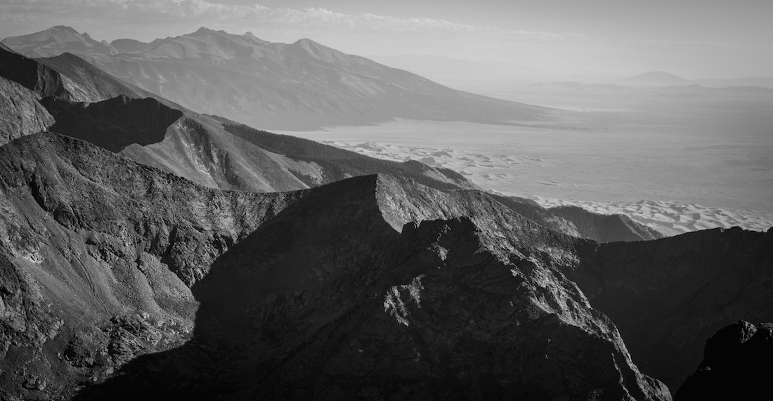
I had learned that the Crestones had been a ~25 year long goal for Pat (with an attempt that had been foiled by snow). It was nice to get to know Connor on our way up, and as we all talked and hiked with heavy packs, we spotted wildlife. Soon enough, the giant Crestone Needle began to loom over us, and it only grew in stature as we approached.

A post-trailhead informational poster described our future endeavors as “very difficult” in bright red text. Within time, we passed a wooden sign indicating we were crossing into the Sangre de Cristo Wilderness.

The intent was to camp at the lower South Colony Lake, but after four miles of uphill hiking, we were dismayed to find Pat’s “spot” taken. It was recommended to us that we try to the upper South Colony Lake, and sure enough, after an additional half mile and >440 ft. of gain, we found a nice flat spot slightly above the upper lake. It had taken us around three hours to get to this spot. The Needle loomed over our camp, a foreshadowing of adventure to come. The sun was in the process of setting and the temperature was dipping significantly.
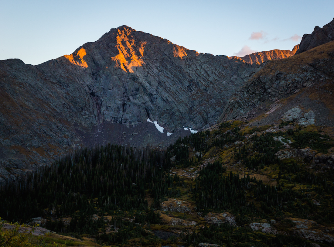
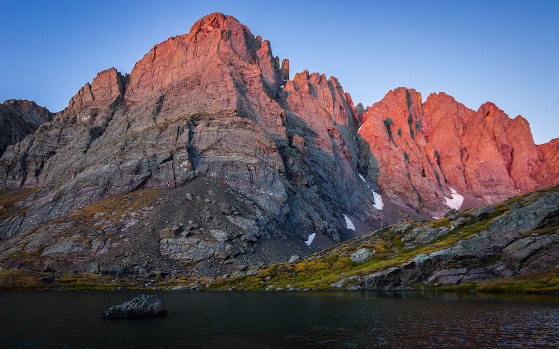
The Needle was soon basked in pearly moonlight. It was dark by the time food was in the works, and I found myself shivering uncontrollably. Warm pasta and tea helped, and quickly, we called it a night. I crawled in my sleeping bag, having already packed in 4.5 miles and rising >2,000 ft. of gain.
Saying I slept that night would be an exaggeration. I’d define it more as a series of ten minute naps, maybe totaling to a couple of hours at most. A combination of loud wind assaulting my (well really, Tyler’s) tent and uncomfortable ground made the night rough. I had wanted to see the alpenglow on the needle at sunrise and had set an alarm, but my phone refused to wake me up. Fortunately Pat and Connor were up as the gold rays of light had already caressed down to the base of the mountain, and woke me up just in time for me to photograph the dwindling event.
Afterwards, I enjoyed a small breakfast and we quickly prepared for our big day. Pat read us some poetry as we drew closer to leaving. We left camp ~8:00AM. Unfortunately, we had to descend back to the lower South Colony Lake to hook up with our route, distance we’d have to hike back up on our return.

At the turn for the standard route, the iconic “Crestone Needle – Standard Route” sign had a printout advising of a missing hiker in the area from some time ago; this served as one of the first reminders that what we were doing was dangerous, and that several people had died and gone missing before on these routes. On the standard route, we worked our way up to Broken Hand Pass (12,850 ft.).
The way up certainly required some class 3 scrambling, especially the section around the crux of the climb to the pass. Jagged spires of rock protruded from the ground, and looking back, Humboldt Peak stood out in the distance. It was weird to think once at the top of the pass that the summit wasn’t actually that far away, but the serious parts of the route were still ahead.
The way from the Broken Hand Pass to the East Gulley, the start of the serious climbing, was fairly well marked, though we got slightly off route on a random foot trail.

In the East Gulley, the climbing helmets went on. The rock was steep enough that I put my DSLR in my camera bag in my pack, as it would swing from my neck strap and hit the rock during some of the scrambling on steeper sections. The East Gulley was fairly straightforward, only scant amounts of water trickled down, and the dihedral was pretty easy to spot.

I’m not sure why, but Pat and I found it difficult to cross over the dihedral (perhaps we were crossing too early), and Connor ended up helping us get across (something I’m sure we could have figured out, but would have wasted time doing so). It was time to work our way over to the rib, and ultimately the West Gulley. I found some of the scrambling up to the rib to be the sketchiest of the climb for me, it was certainly steep and moderately exposed rock. I also struggled with having only my Osprey 70L pack (as a smaller pack is better for actual climbing – I couldn’t even really tip my head up with my helmet on to examine the route easily!). We passed through the notch and found ourselves in the West Gulley. As someone had mentioned in a trip/conditions report on the 14ers website, this area was marked with a green and orange bandanna, which was super helpful for route finding on the descent. The way up the West Gulley was steep, and Connor and Pat worked their way reasonably far ahead of me towards the summit. I enjoyed the steep ramp after the West Gulley above 14,000 ft. (I thought the rock was a bit better), and soon enough, around 11:00AM, we all stood proud at the summit.

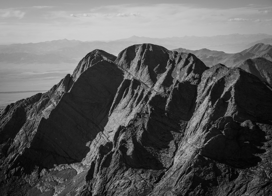
I was nothing short of giddy. We shared the summit with several other climbers, though we had seen nobody during our ascent. From the summit, Crestone Peak (our next destination) loomed in the distance, and we could see small dots of climbers reaching the summit. Pat pointed out the majority of the route as it could be seen, almost the entirety of the Red Gulley (the largest portion of the way up.) Kit Carson Peak was also visible in the distance. We ran into a couple that we had seen the day previous that had ascended the Needle via the Ellingwood Arête route. I was stoked to be with Pat as he achieved his ~25 year goal, and I was somewhat surprised with myself to have gone as far as we had.

My excitement was only slightly lessened by the fact that it would shortly be time to descend, which is actually when most climbers get hurt (something about gravity or something).

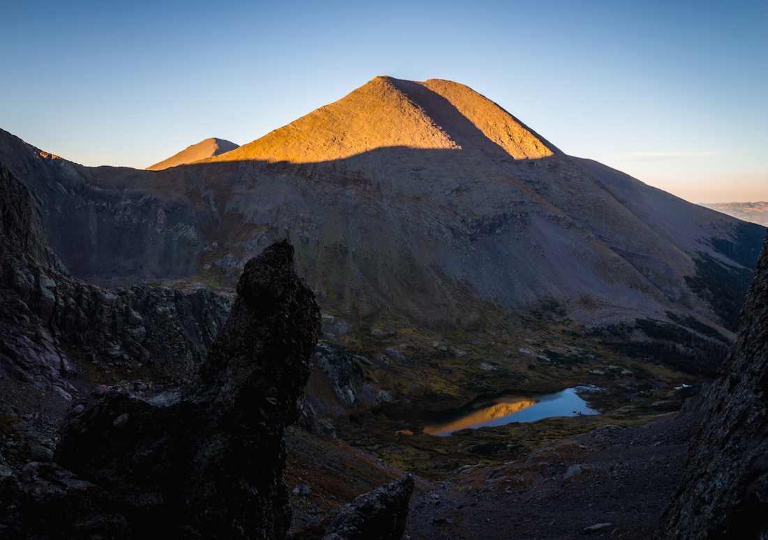
I had nothing really to worry about, as whilst we made our descent, we went plenty slow, taking time to down climb the difficult sections. Connor’s helmet turned out to be of great use as a fairly large rock had slipped and fell on it. There were sections that it was almost impossible not to kick down loose scree/rock, especially in the West Gulley. The crossing of the dihedral was easier, requiring (from where we crossed) a small leap. In time we found ourselves back at the Broken Hand Pass and, sparing no time, we made our way down to Cottonwood Lake (~12,320 ft.).

I admit to a certain fascination in alpine lakes, and Cottonwood Lake was no exception to my enchantment. I saw similar almost perfect rainbow gradation from the shore to the intense cerulean hues of the water as I did in Sloan’s Lake (mentioned in a previous trip report).

We all took the time after eating some lunch to swim in its frigid waters, almost as a way to energize us for the rest of our adventure. As we prepared to attempt Crestone Peak next, we talked to some climbers who hadn’t summited, stopped by the difficulty of the Red Gulley. They seemed surprised that we were attempting both standard routes in a day, but I don’t think they were quite as incredulous as my legs might have been. I suspected I could ascend the difficult route remaining, but I could tell my legs were not going to be happy about it, and it’d take me some time. We hiked till we reached the start of the Red Gulley.

While Pat and Connor seemed to breeze up the entirety of the ~1,000 feet of gain, I arduously found myself slowly and absent mindedly maneuvering up the very solid rock. I kept getting glimpses of Pat and Connor’s helmets in the distance above me, and would think, “alright, just gotta get to that point there.” I also would occasionally think on steeper sections, “Sketchy Town – Population: Me,” though I cannot emphasize how much easier I found Crestone Peak to be contrasted to the Needle (my exhaustion set aside).

It was just so straight forward, and much of the rock was fantastic. While we did run into maybe eight people descending, after I reached the notch at the top of the Red Gulley, not a soul outside of ours was to be seen on Crestone Peak. From the notch I slowly made my way over to the ledges and the final pitch of scrambling. It was certainly more fun of a scramble (less tedious than the gulley) and it took no time to summit. “Marrow of the World!,” I weakly shouted on my summit, and we shared a laugh.

It was around 4:00PM. From this summit I could look back at our previous accomplishment of the Needle, and I could also see Challenger Point (to the left of Kit Carson), a 14er I had climbed this summer, and can be read about here.
I had absolutely no clue while I stood on the summit of Challenger gazing at Crestone Peak that I’d climb it this season. Below, the Great Sand Dunes were carved into the uniquely flat landscape of the San Luis Valley.
After sharing our enthusiasm and snapping a few pictures, it was time to descend.

Again, Connor and Pat went much quicker than I did, and I admit to feeling a little guilty for slowing them down. In time we were back on the solid trail around Cottonwood Lake, but we had to re-ascend and descend Broken Hand Pass.

The sun was setting, but Pat and I decided to take another dip into the cold and beautiful lake. As the hike proceeded, I became slower and slower, and on the descent from Broken Hand Pass I found myself increasingly sketched out by loose terrain, partly thanks to my sore legs and lessened balance. I slipped onto my ass a few times, but nothing major. The down-scramble from the crux of the climb up to the pass was a little challenging, with loose debris scattered across the solid rock in the narrow section. Finally, we found ourselves back on good, solid terrain, working our way down to the lower South Colony Lake. Again, we had to re-ascend back up to our camp. It’s rarely fun to end a day on an uphill. We found ourselves back at our camp at 7:40PM. This day alone had entailed a grueling 5,500+ ft. of vertical gain in the short span of only ~8.4 miles. I confess I felt somewhat loopy on the way back in the dark towards camp from the lower South Colony Lake, with weird sudden mood swings and intermittent random giggling. It felt so amazing at camp knowing we were successful in our endeavors, and that the day was drawing to an end. Connor cooked up some good chili-mac with corn, which I scarfed down as it began to get frosty out once again, and in no time I was back in my uncomfortable cradle of sleep-lacking sleeping bag.
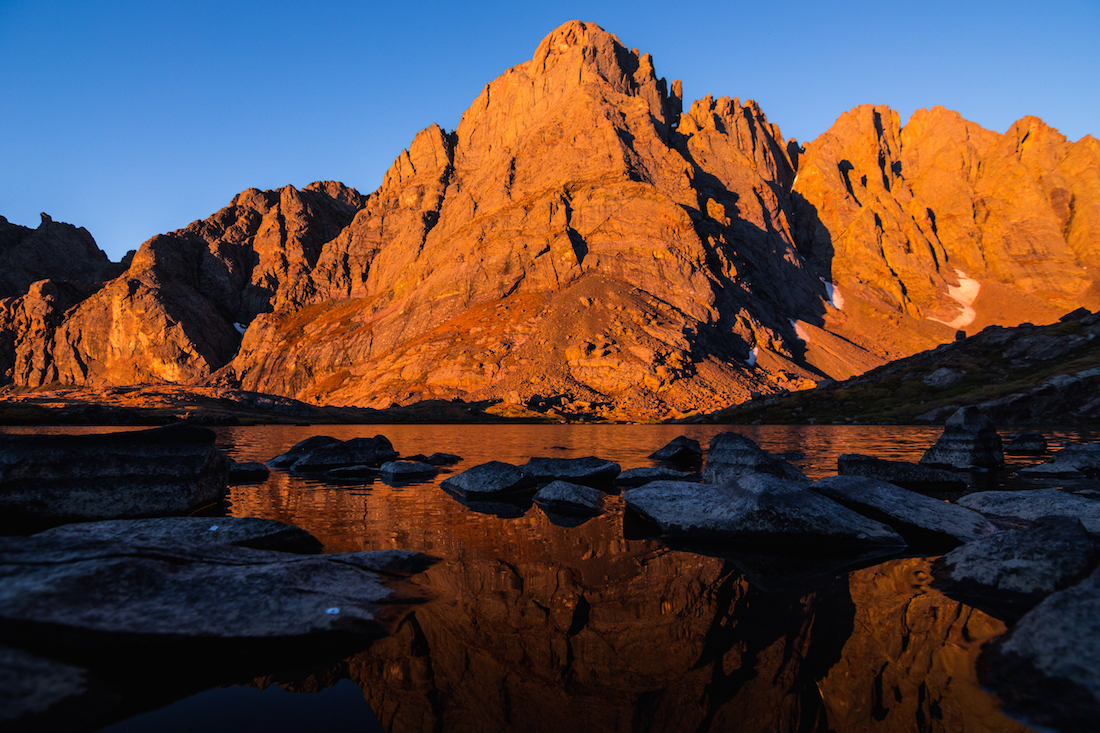
After somehow getting even less sleep than the night previous, I decided after waking up at 5:30AM to just get out of the tent and wait for the alpenglow on the Crestone Needle. I walked around the lake a bit, enjoying the crisp morning air. Unlike the morning previous, I got to witness the rose and light blood red hues of alpenglow caress the mountaintop, the namesake of the Sangre de Cristo (translation: “blood of Christ)” Range. Enamored by the moment, I took time to both enjoy the sight and to try to photograph what I saw.
It was tough getting both the lake and the peak in the frame, even as wide as 14mm. We enjoyed breakfast, a little more poetry, and then began to break camp. Time was a blur as we soon found ourselves rucking down the trail, and I profess a sense of sadness to be leaving the area. It was hard to be so close to Humboldt Peak and to not climb it, but my legs were done after the two days prior. The way back was sunny, and we passed through brilliant golden patches of Aspen once back on the road. Another grave reminder of the danger of the days prior revealed itself in multiple search and rescue vehicles parked as far as they could get on the road towards the trail. I hoped everyone was all right. The 4.5 miles back felt a whole lot longer than it had going up, but soon enough, we found ourselves loading up our cars, and saying goodbyes. The drive back to Gunnison felt brief, but I think we shared a certain feeling of enrapture for our weekend’s great adventures, and I couldn’t help but feel mighty appreciative of Pat and Connor for having me along on the ride. Until next time, stay adventurous, my friends.

~Skyler
