El Diente Peak. A high mountain summit within the San Juan Range named for its tooth-like visage (El Diente translates to “The Tooth” in Spanish).
If this peak is the tooth of the San Juans, then these mountains have clearly forgotten their oral hygiene. El Diente Peak, and its neighboring summits of Mt. Wilson and Wilson Peak, are notorious for their ever-eroding slopes—a nightmare of loose scree and talus.

We had been planning this trip for months. In June, I had been in communication with Dr. Pat Magee!, a friend and professor of mine that I had the opportunity to climb the Crestones with (an entry for which can be found here). We had made plans to set out for a climb of Mt. Wilson and El Diente Peak. The summits of these two infamous peaks, connected by a mile-long jagged ridge, are destinations for the tenacious and willing.
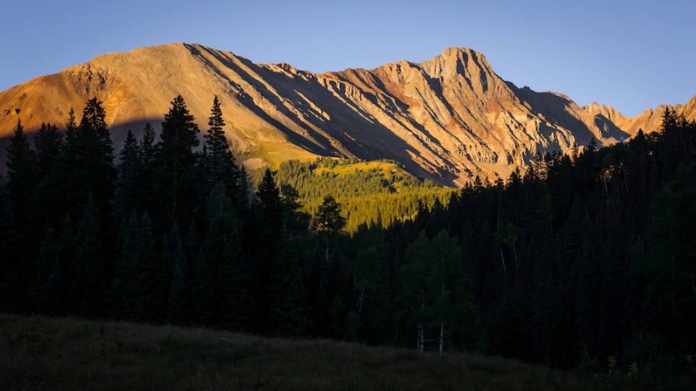
After a stressful series of unfortunate postponements, road closures, and detours, we finally managed to make the drive after Friday classes from the prosaic confines of Gunnison to the Navajo Lake Trailhead. Our group had now expanded to include my friend Alex and Dr. Magee!’s sister, Caitlin. Once at the trailhead, we immediately started backpacking in.  We made it only just beyond the cutoff for the Kilpacker trail before the sun had fallen, an opportune time to set up camp. On our way, El Diente’s summit prodded the darkening sky, painted scarlet by the setting sun.

After setting up camp and enjoying dinner by headlamp, we retreated to our tents with high aspirations for the day to follow.
Alex and I had wanted to traverse the one-mile connecting ridge between El Diente and Mt. Wilson, so we arose earlier than the rest of the group to get a head start. In the darkness we marched, crossing streams and locating the turn to the Kilpacker trail.  Here, we paralleled Kilpacker creek. The silhouettes of the behemoth peaks to our northeast were accentuated by starlight. As we ascended above timberline, the empyrean slowly began to glow with morning light.

Dolores Peak and Middle Peak stood tall to the south, and light caressed their summits as we continued up the arduous rock trail. The shadows of our target peaks were subtly etched in the refulgent, golden alpenglow.

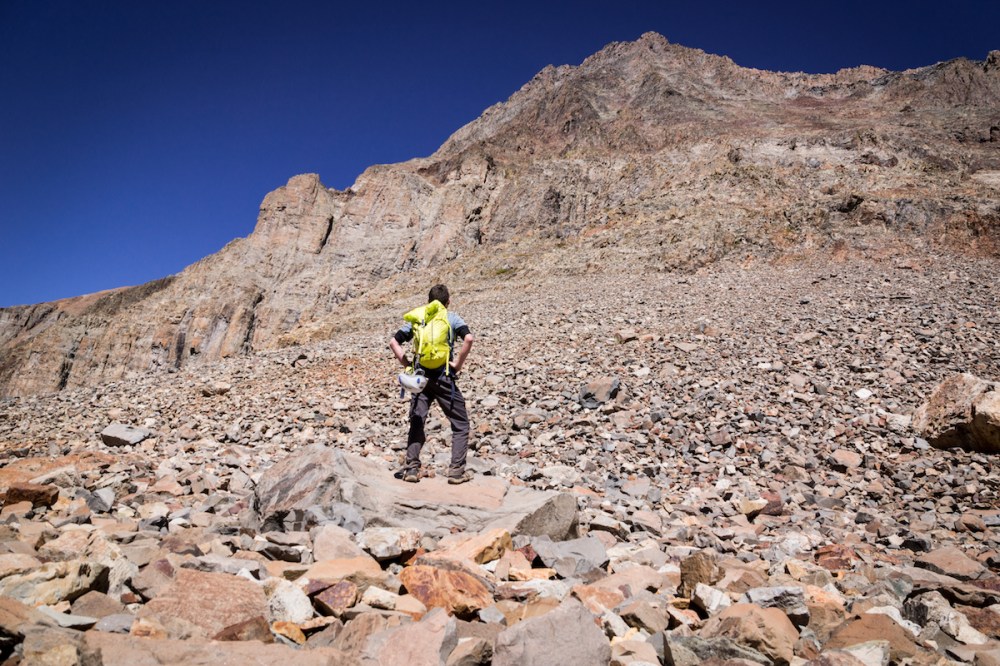
We paused at the turnoff for both mountains to hydrate and eat. In our pause, the cold seized us and motivated us to continue, trading the rocky approach trail for the loose southwest slopes of El Diente.

Pesky talus and scree made the way slow and demanding, though the route was initially kept to class 2 difficulty, reminiscent of the lavender couloir of Mt. Sneffels. This lasted until we reached the black painted cliffs. Here, the sun greeted the basin and the route finally became class 3.  Route-finding was also now a challenge. Spotting cairns in the rotten mess of the southwest slopes was a chore. It would often be difficult to decipher if rock piles were manmade or just dropped carelessly from the mountain.

Additionally, locating the topographical features in the 14ers.com route description presented a similar challenge. We entered the first gully after the red rock rib and scrambled up towards the organ pipes.
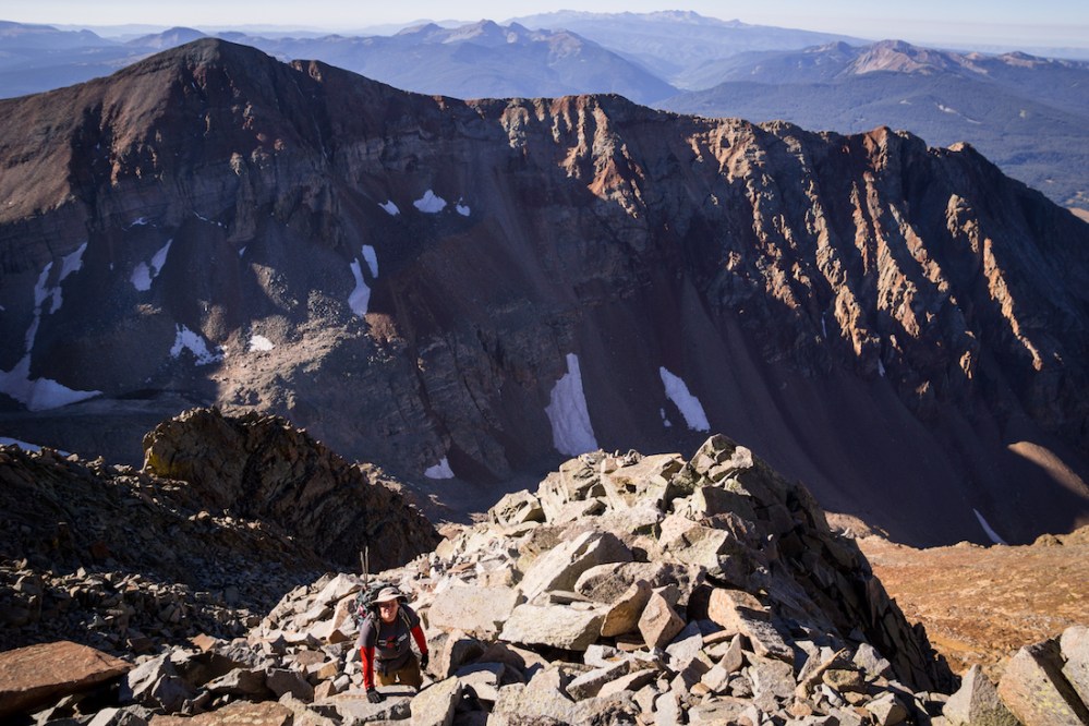
We made the mistake of ascending all the way up to the ridge crest instead of continuing west below the organ pipes. Thanks to the sporadic cairns we did locate, I attribute this mistake to accidentally following a small portion of the traverse. Realizing our mistake, we descended a little and fought our way west.  We entered another loose gully and neared the ridge crest and subsequent crossover at 13,900-feet. This portion of the route was rotten enough that knocking rocks on other climbers became a serious concern. We made the crossover and were greeted by what I found to be the most difficult section of the day.
Summer-like conditions! a conditions-report on 14ers.com had advertised. This was a relief considering it had only been a week prior that these peaks had seen several inches of dangerous winter-like graupel. After the crossover, three mandatory small snow crossings became visible.
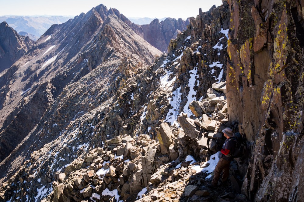
While these small sections likely did not present any serious danger, and most people were able to go across them just fine, I felt great unease on them. After such travails, it was a breeze to top out. We shared the summit with five other climbers. Alex and I slowly decided against our initial plan to traverse to Mt. Wilson; Alex needed to get back to Gunnison and I wasn’t prepared to do the traverse without a partner.

On the summit, Mt. Wilson dominated the view to the east, beckoning me.

Many of the rugged San Juans could be seen against the skyline. Deciding to bail on our plan, we started descending. I settled on returning to the Kilpacker basin and doing a separate ascent of Mt. Wilson if I were in good enough condition to.  This is what Dr. Magee! ended up doing. Alex and I ran into Dr. Magee! and Caitlin about thirty minutes into our descent. We exchanged pleasantries and bid each other good luck.
  Returning to the basin was a slog of loose nastiness, and by that time, I was sick enough of the maddening scree to call it a day. Alex talked me into packing out with him and returning to Gunnison that night. Descending in daylight allowed for excellent views of the peaks on our way out.

Though now disappointed by my decision to not go for Mt. Wilson, it was a phenomenal trip with outstanding people. Regardless of the nasty terrain these peaks include, I am beyond excited to return to this unique part of Colorado.
Until next time, my friends, stay adventurous!

One thought on “Tooth Decay”