Missouri Mountain, Iowa Peak, and Emerald Peak Grand Slam
~15.5 miles round-trip; 6,300′ elevation gain.
The turn to Chaffe County Road 390 and its subsequent vexatious washboard ruts felt all too familiar. Five months ago, I had kicked off the 14er season with ascents of Mt. Belford and Mt. Oxford—two of the three 14ers that rise high above the Missouri Gulch. Now I was returning to the Missouri Gulch trailhead to attempt my last Sawatch 14er: Missouri Mountain. A pleasant, dry November gave way for summerlike conditions in much of the Sawatch Range. Fortunately, unlike my last sojourn to the Missouri Gulch, this time I had company. My good friend Anica (who is no stranger to the Overcast Adventurers) was able to meet me at the trailhead. After we parked, we exchanged joyful greetings, donned our packs and jackets, and soon crossed the Clear Creek bridge to head up the trail.
Our conversation distracted us from the difficulty of the early switchbacks that guard the entrance to the Missouri Gulch. A thin layer of snow and ice shrouded the trail past the crossover to the east side of the gulch at 10,800′.

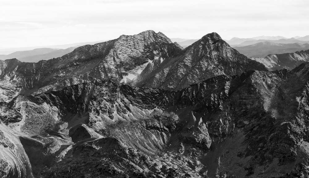
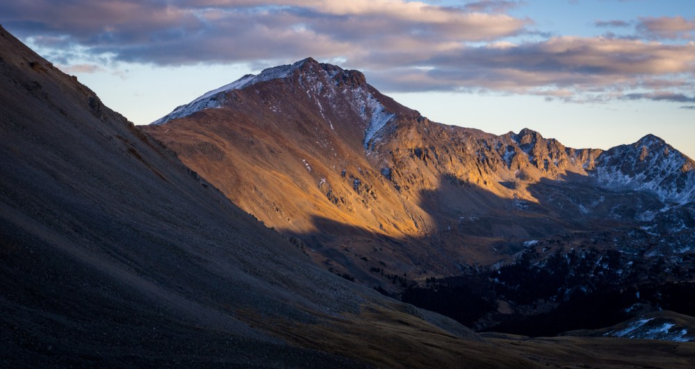
We carefully continued our ascent and the massive Mt. Belford came into view as we passed by the old mining cabin at 11,200′. Its north aspects were obviously covered in snow and ice and made me worry about the conditions up high on Missouri Mountain.

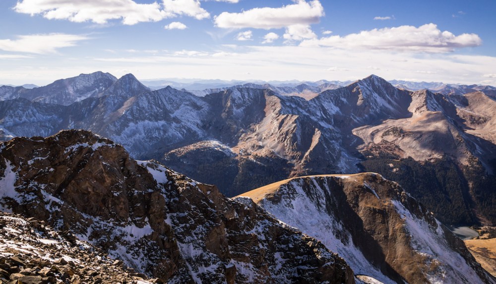
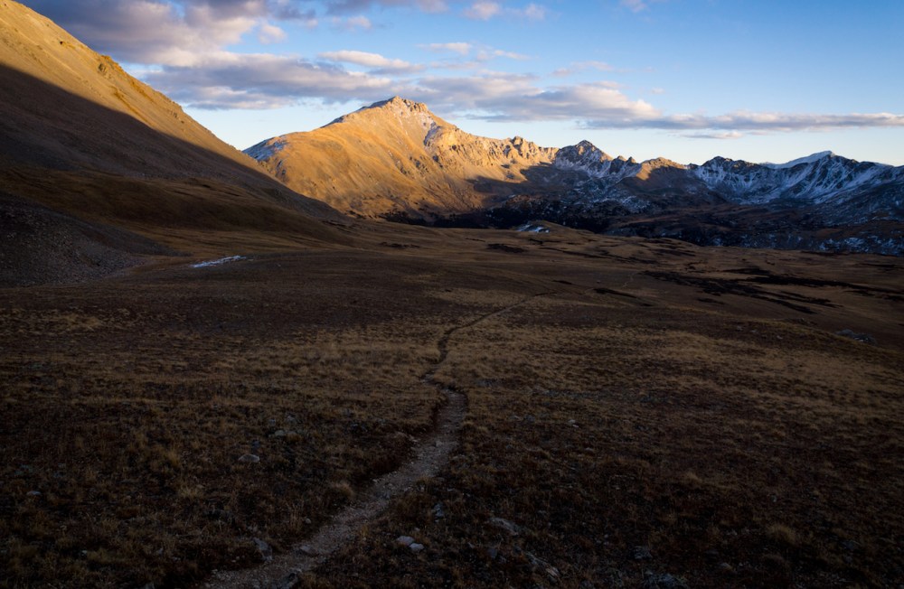
We passed by the Mt. Belford junction and continued upwards toward Elkhead Pass. The trees thinned and slowly disappeared as the alpine transition gave way to hallowed ground. As we advanced, the vast north face of Missouri Mountain came into view, complete with a chilly blanket of powdery, seemingly innocuous snow.

We stopped for snacktime shortly before the trail fork that separates Elkhead Pass and Missouri’s standard northwest ridge route.
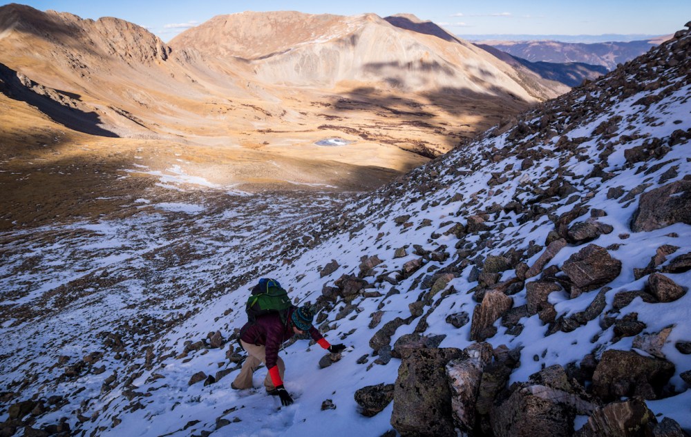
Our ascent was unhindered by the snowy switchbacks of the slope connecting to Missouri’s northwest ridge. I had advised Anica to buy microspikes for our climb and they ended up staying in her pack the entire way.

A looming view of Huron Peak dominated the west as we gained the ridge.

Only intermittent snow and ice topped the long ridge as we worked toward the summit.

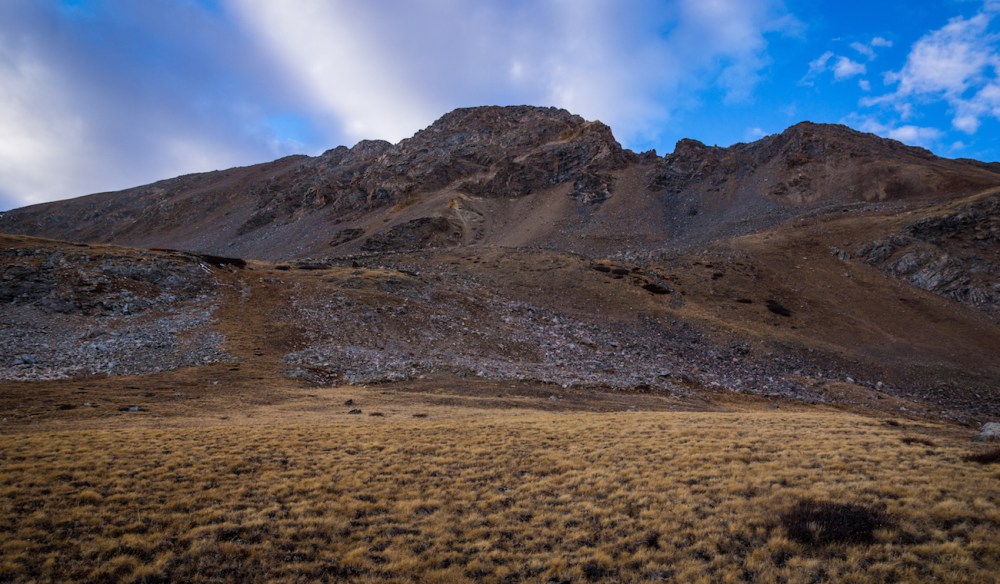
We passed by other climbers near the crux of the route: a brief, difficult class 2 section of loose gravel with some exposure on the right side of the ridge. Luckily for us, the crux was dry. Post-crux, it was only another minute of ascent before we topped out.

We had our usual summit hijinks and were joined by the other hikers. We caught our breath and snapped photos at the zenith of our adventure. I was surprised; Missouri Mountain was easier than I had expected. I still had some umph left. I introduced the idea of descending Missouri’s south ridge to try to knock out Iowa Peak and Emerald Peak to Anica. Iowa and Emerald are centennial 13ers—the highest forty-seven 13ers that comprise Colorado’s 100 tallest mountains when added to the fifty-three “ranked” 14ers (although Iowa Peak is actually unranked). The 13ers just looked so close by.

Why not try, at least? Anica seemed apt to give Iowa Peak a shot. We began our determined descent and waved the summit of Missouri Mountain goodbye.
It might not be obvious to most readers, but Anica had just made a classic novice mistake. She listened to me. Any outdoorsman or woman should know not to encourage my insatiable summit cravings. This would be an oversight of Anica’s that would later come back to bite us.
The descent of Missouri’s southwest ridge to the saddle between Missouri and Iowa went by quickly, although the elevation loss was considerable.

On the saddle, we spared no time to dally before ascending Iowa Peak’s northeast ridge. Iowa’s unranked status was borne out by our quick ascent.
At the summit we found a summit-register canister filled with papers that looked ancient and crumbly. We shared a laugh and began descending Iowa’s southeast slopes to reach the boulder-laden saddle between Iowa Peak and Emerald Peak.

I admit: Emerald Peak looked almost undoable. We were already fatigued and would have to reascend over 500′ from the Missouri Basin to reach Elkhead Pass so that we could return to the Missouri Gulch to get home. From the saddle we would have to ascend an additional 500′+ to summit Emerald via its standard north slopes route. These slopes were covered in the most snow and ice we’d see on any of the mountains in our summiting frenzy. The snow and ice looked rather sketchy paired with the steep, trailless grade.

With all signs pointing to save Emerald for another day, I yelled “youth culture forever!” and we began to ascend.
Emerald Peak’s stature from afar was daunting. To actually ascend was another class of ambition. Some of the snow and ice certainly felt sketchy but our microspikes remained in our packs nevertheless.
Slipping and small spills became the norm as we made our way up.

Every step became painful and our pace slowed significantly as we approached the summit. It was amidst heavy panting and profanity-spewing that we topped out. I gave out a cry of sweet and fatigued relief. An ineffable summit-euphoria overcame the exhaustion our arduous toil. An intruder of doubt knocked at the door of our spirited summit celebrations. Uh-oh.
Tacking on these unexpected, additional summits had taken substantially more time than we had anticipated when we planned to only do Missouri Mountain. Anica remembered that her friends were waiting for her and that they would worry when night fell and she hadn’t contacted them. The promise of darkness was only a few hours away and we were at the furthest possible point of our journey that we could’ve been from the trailhead. Shit. We began to descend from Emerald Peak toward the Missouri Basin.
The descent took long enough. With no trail on these peaks (only one further down in the Missouri Basin), we did our best to make a beeline towards Elkhead Pass. As we descended, we stumbled across a group of at least seven ptarmigans that seemed largely unconcerned with our frantic campaign to escape the Sawatch.

In the Missouri Basin, we passed by the shores of two frozen and unnamed alpine lakes. We traded our descent from Emerald Peak for the rolling ascent up to Elkhead Pass.

The parting daylight was made obvious by the tangerine alpenglow that embraced Mt. Harvard to our east.
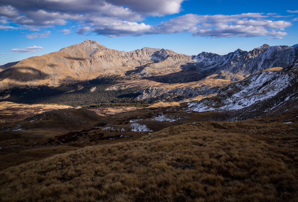
Missouri Mountain overshadowed us from the northwest as we slowly ascended.
Our arrival at the top of Elkhead Pass marked the final moments of daylight. We were still 4.5 miles away from the trailhead. I let Anica soldier on as I ascended part of Missouri to get a signal on my phone so I could notify Anica’s friends that she were safe. Alas, this was to no avail.

I jogged to catch back up to Anica and we made fantastic pace as we continued down. Anica’s feet deteriorated as they were gradually overcome with blisters. This slowed us down. I let her borrow my extra socks and, like a champion, she persevered through the affliction. We made it back down to timberline in darkness and eventually returned to the many switchbacks that guard the entrance to the Missouri Gulch.

When will you end?!, we yelled at the switchbacks on our way down. Our only indication we were getting close to the end of our journey was the roaring of Clear Creek. We crossed the footbridge and made it back to the trailhead only eleven hours after our 8 a.m. start. “That was fun and also kind of awful,” we joked as we loaded up our cars. Our triumphs were cruelly contrasted with the new kinds of pain we felt on our descent. Despite this, I had only four words to summarize our victory at the bottom: it was worth it.

Until next time my friends, stay adventurous!

One thought on “Sawatch Me Do Three”