Hi everyone! A few weeks back, Skyler did a short post about hiking around Moab (here). The pictures and stories were just so great that I decided to come out of hiding and drive out to that area with Skyler over a long weekend. We decided last-minute to do our hiking in Canyonlands National Park, and the Needles District therein.
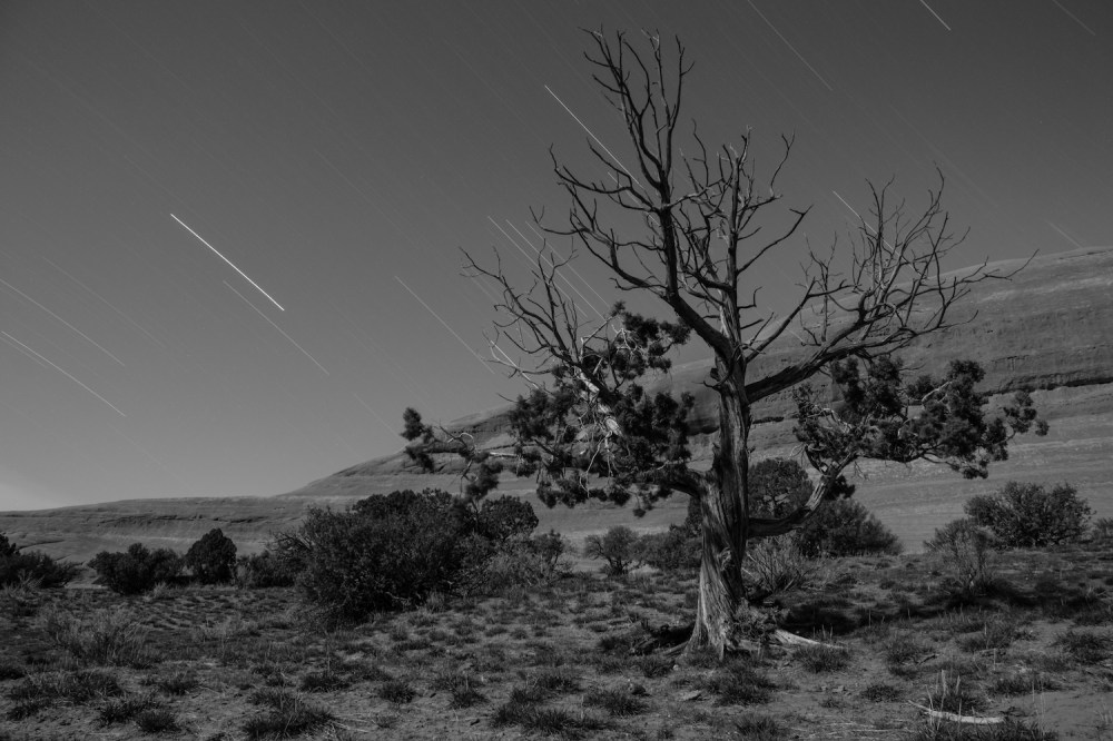
We left Gunnison via Highway 50 on the evening of April 7th. The drive to Moab from Gunnison, for anyone following speed-limit signs, takes about 4 hours. Fortunately for us, traffic was fairly light up until reaching Moab proper. It turns out that this was because everyone else had gotten to the town that morning. An attendant at the visitor center told us that it was one of the busiest weeks of the year, and that we’d be hard-pressed to find campsites. That warning must have only been in reference to paid camping only, as we were able to find a beautiful space next to a red rock outcropping on the BLM land along the Needles Overlook road. There wasn’t any water, a bathroom, nor a concrete pad for us to set up a tent on. But hey, it was free.
The night was a windy one, which is kind of lame when you’re sleeping in a tent. We survived to Saturday morning, and started packing up camp as the sun was rising. There were very few other cars as we drove into the Needles District (a good sign), though we ended up circling around several different roads while trying to find the trailhead for Druid Arch (a bad sign).
Despite confusing sign posts in the park, we were able to make our way to Loop A of the Squaw Flat campground, where our desired trailhead was located. Several other cars were already parked nearby, making us nervous. As we headed south on the trail into Big Springs Canyon though there was nary a soul in sight. It was 8:30. With the temperature hovering just below 70 degrees, a few clouds in the sky, and a slight breeze, it was almost a shame not to see more people out enjoying the day. Almost.

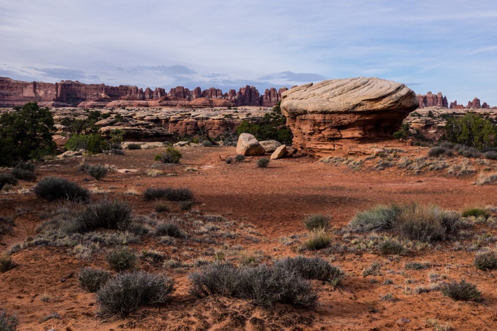
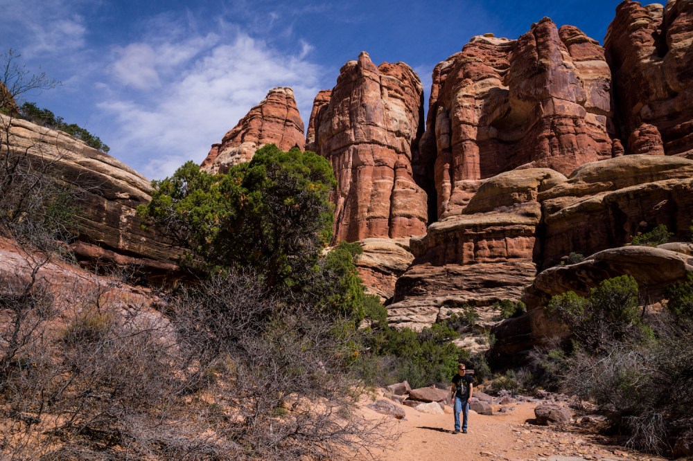
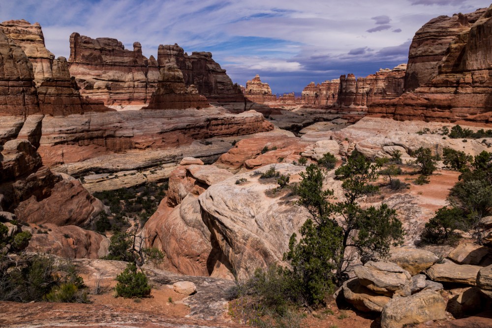
Our first encounter on the trail, about a mile in, was with a park intern who described the rock formations around us. I won’t share those details here, mostly because I don’t remember them. I’m a biologist, dammit, not a geologist. We parted ways with the intern as we crossed over a ridge into the main canyon. The route over the ridge was well marked by cairns, as the way forward would not otherwise be apparent on the large swathes of open rock.
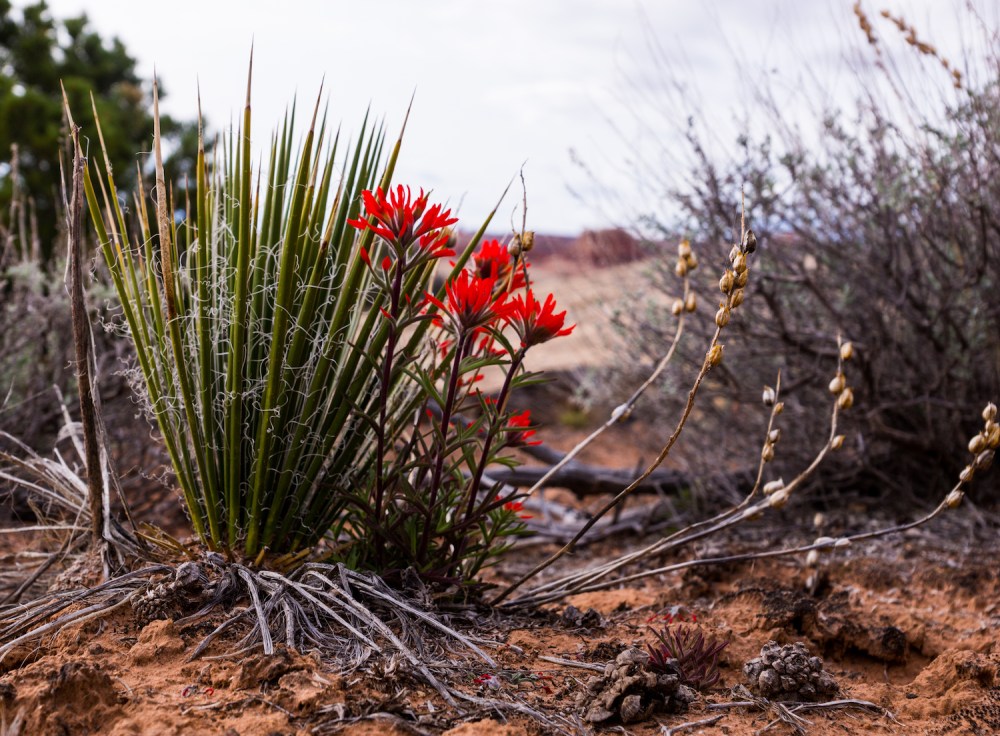
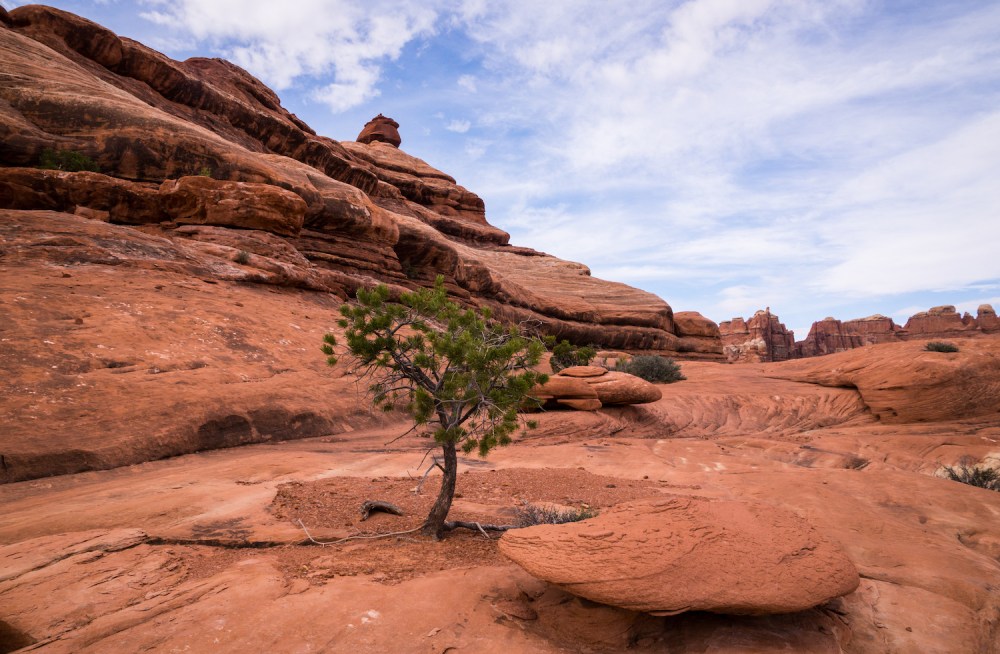
Big Spring Canyon itself did not actually appear to have much in the way of water, from a spring or otherwise. We passed by one stagnant pool, home to a few insect larvae. The amount and diversity of plant life in the canyon seemed to contradict our observations though. The intermittent patches of sand and red dirt were alive with lichens, trees, and wildflowers stretching up to enjoy the emerging spring season. The trail brought us through a slot canyon at one point, which was a gateway to an entirely different atmosphere. We were descending to some of the lower parts of Canyonlands.


In certain desert canyons, there are long stretches of silt and rocks that look like dry riverbeds. And really, that’s what these areas are: routes by which water flows only seasonally or during sporadic rainstorms. In the American west, these dry riverbeds are called “washes”. They make for great hiking, so long as there isn’t a flash flood.
Skyler and I descended into one such wash, which was again well marked by cairns and signs. The skies also chose this moment to clear away the clouds, and the temperature spiked up ten degrees. While in the wash, we also passed several shadowed pools, which meant there was more wildlife. Primarily that wildlife took the form of insects. Mostly flies. These flies mostly kept to themselves though, unlike their cousins in the canyons of eastern Colorado (which was a whole other experience, one that can be read about here).

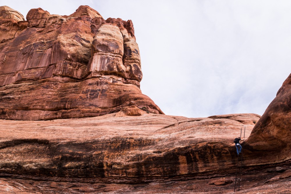
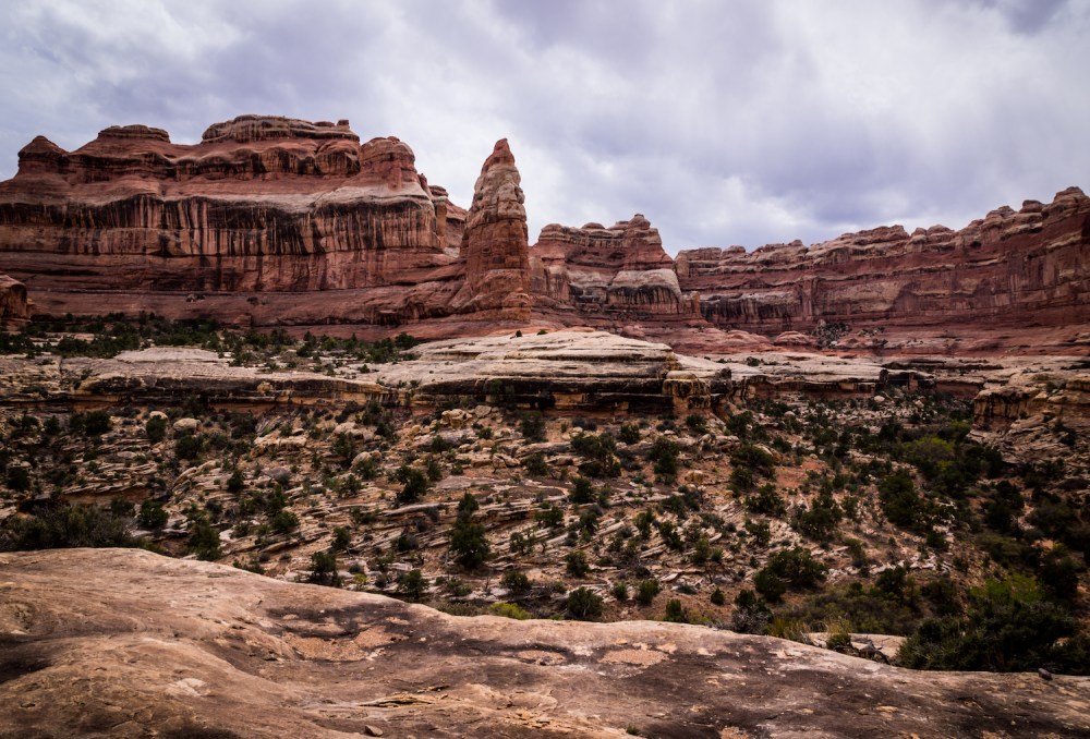
The wash forked after roughly a mile, letting us turn onto the main Druid Arch trail. We reached a point where every bend we rounded in the canyon left us looking up at the rocks and wondering which was the arch. The funny thing with Druid Arch is that you can’t actually see it as you’re approaching it. The route eventually took us slightly to the east, where some rock scrambling and a small metal ladder brought us into view of Druid Arch. That monolith is difficult to describe, and even Skyler’s wonderful photographs don’t fully do just to its awe-inspiring nature.
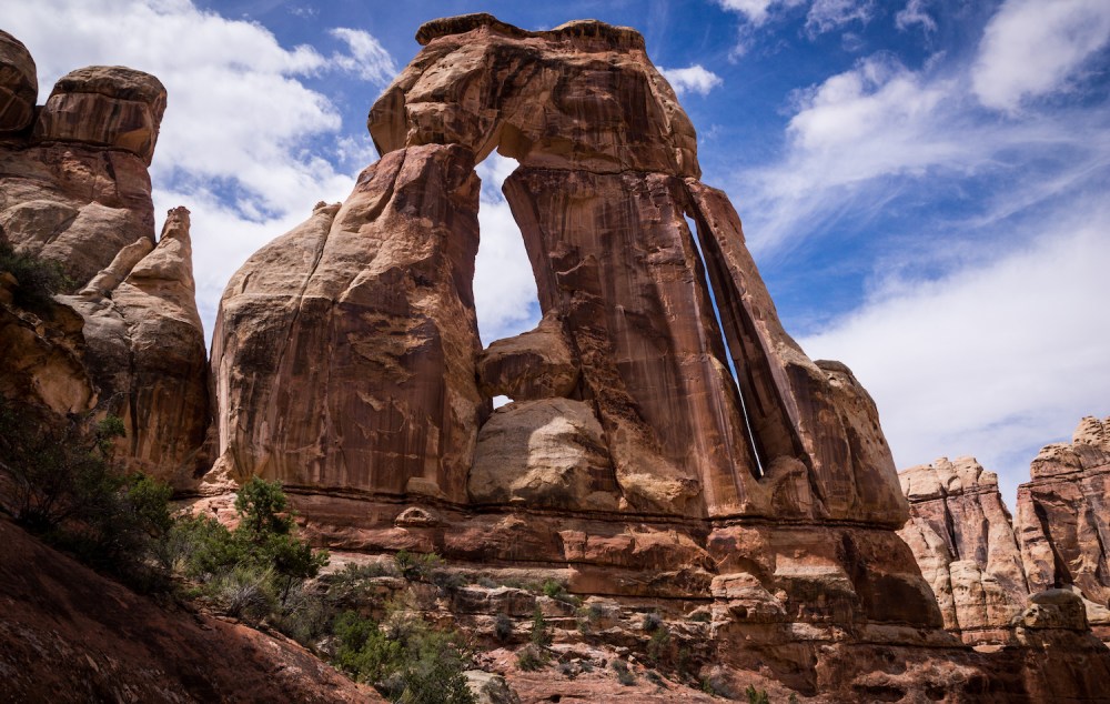
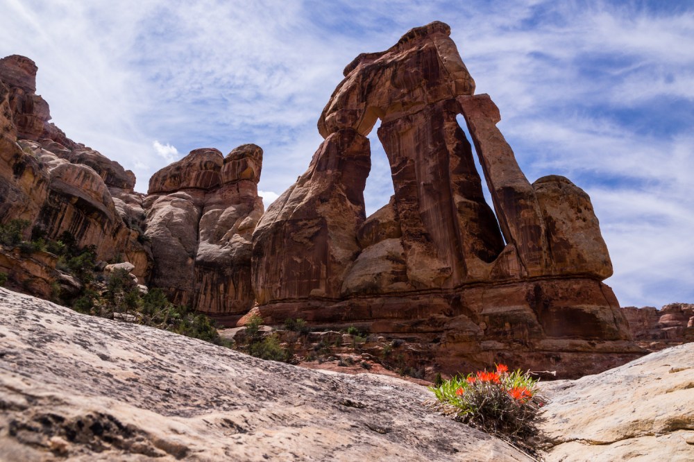
The thrill of accomplishment and endorphins, of course, make for an experience that can’t be easily replicated. We set our packs down at 11:45 and took in the sights for a good long while. After the winter season and its blues, this desert arch was just what the doctor ordered. At our arrival, only three other hikers were at the arch. When we finally left a while later, a few other groups were starting to make their way up. As we followed the wash back north, we passed several more groups, probably totaling around fifty people. Starting the hike early had worked in our favor, as it often does.
Upon reaching the trail fork, we decided to not return via Big Spring Canyon. Instead, we took a right turn and headed towards Squaw Canyon. The new section of the wash that we traversed verged on verdant. The trail even crossed through a large meadow before climbing back up into bare sandstone. It was only a couple miles to the end of the wash, at which point there was a metal ladder mounted into the rock.

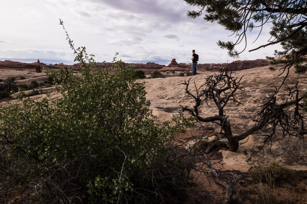
The ladder brought us over an opening in the canyon walls and out onto a lip encircling Squaw Canyon. From there the route followed this lip on the canyon’s edge. At times the cairns were difficult to spot, and there ended up being some exposure as the trail meandered along cliff edges.


This cliff-top portion of the hike extended for several miles and then abruptly ended as the trail went through a small cave. The cave, which had probably seen its fair share of broken ankles, didn’t have a floor, just rocks and logs jammed in over top of a narrow abyss. In terms of footwork, it was the most interesting part of the hike. The other end of the cave let out onto a small plateau above a creek, with cottonwood trees and grass replacing the warped junipers we had mostly been seeing.
The final leg of the hike dragged. Maybe this was because we were already exhausted, maybe it was due to that part being a bit monotonous. Either way, the final four miles of walking through grassland wasn’t as impressive as the rest had been. When we finally rolled back into the trailhead parking area at 4:40pm, we wanted little more than dinner and some sleep. Which, with a drive first back into Moab and then back out to our previous night’s campsite, we accomplished. In checking our map, we found our hiking route to have been about 16.3 miles.
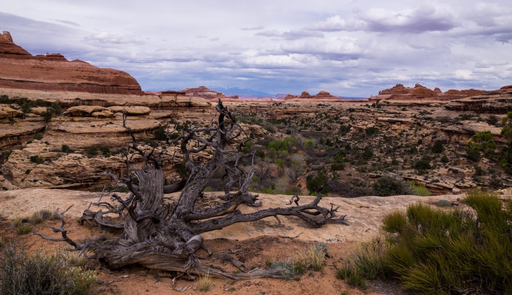
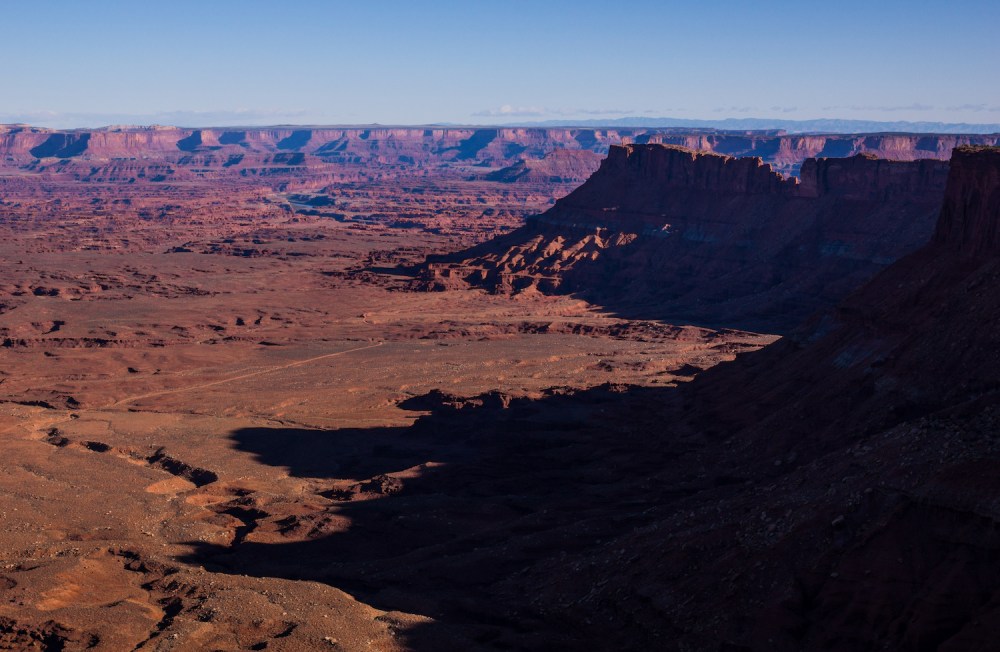
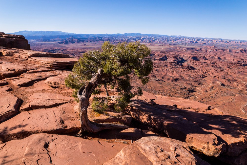
The second night was far windier, and we woke up frequently in the night to find ourselves covered in sand, which had blown in through the tent mesh. It made for a groggy morning the next day. Grogginess is, of course, best cured by adventure. So, we packed up and drove the rest of the way to the Needles Overlook. We were the only ones there to bask in the open panorama stretched before us.
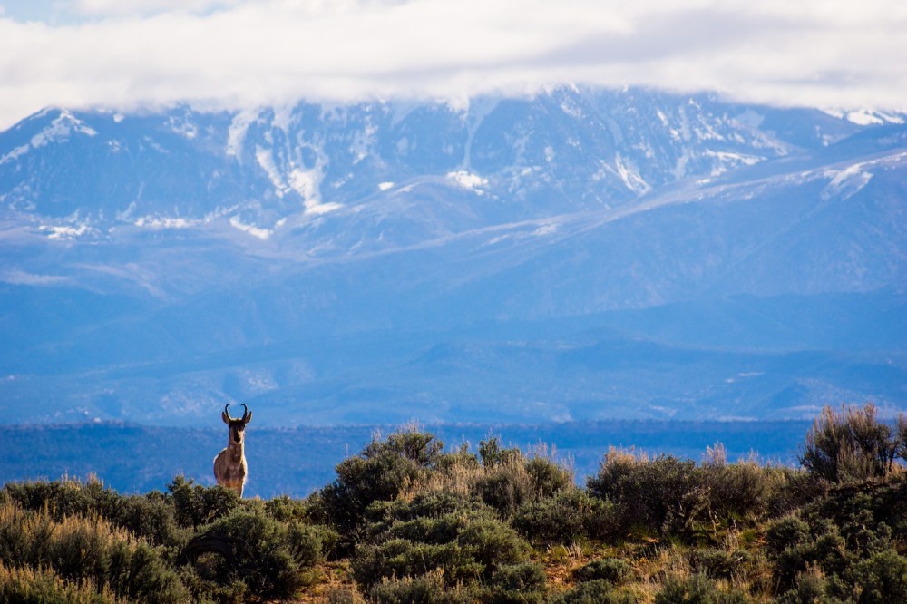
On the Needles Overlook road was a turn-off onto a major dirt road which, on every map, looks like it connects back to Moab. About ten minutes up said dirt road, the realization hit that the route didn’t connect through. It was an honest mistake, and a fortuitous one at that. A pronghorn ran up alongside us, and stuck around long enough to get his picture taken.
The remainder of our drive back to Gunnison that day was composed of desert vistas and the Westworld soundtrack rolling off of the stereo. Overall, this Moab trip seemed like a pretty good start to what’s sure to be an exciting season!
Until next time…

~Sky & Ty
(Pictures courtesy of Skyler Stanley, words courtesy of Tyler Brant)

3 thoughts on “Druid, Where’s My Car?”