A lazy weekend. My last day of classes. Encroaching finals week. These are the perfect ingredients for end-of-the-semester cabin fever. While there is no known cure for this cabin fever–medically speaking–adventuring seems to usually treat such an ailment. The Hermit’s Rest trail had been on my list for several years. Near the eastern terminus of the Black Canyon of the Gunnison, the Hermit’s Rest trail ends at the shores of the Morrow Point Reservoir. Sound familiar? That’s because Ty and I encountered another section of the Morrow Point Reservoir in a previous blog.
Lady Fortune smiled down on me as I arrived at the trailhead, where a large group of boisterous schoolchildren were getting onto a bus to leave. As I set off down the trail, I encountered the stragglers from the field trip paired with a miffed teacher. Immediately from the trailhead, the reservoir can be seen almost 2000 feet below. Its cerulean waters gleamed like turquoise in the sunlight, beckoning me to seek out its shores.

To the south, high above the reservoir, I noticed the rugged Cimarron Range. My gaze was immediately drawn to the unmistakable contours of Courthouse Mountain.

I had the chance to climb Courthouse Mountain last fall, which can be read about in this blog. With further scrutiny, I could make out some of the larger San Juan mountains beyond the Cimarron Range: the high summits of Uncompahgre Peak (pictured below) and Wetterhorn Peak graced the heavens above.

So engrossed in staring at the larger snow-covered mountains beyond, I found it key to occasionally remind myself of the day’s true destination. The trail, as it descends into the Black Canyon, starts with steep switchbacks through scraggly oak brush and aromatic sage.

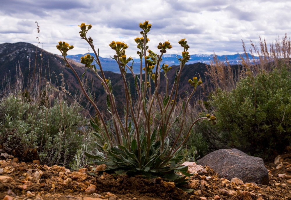
A keen eye might notice a rare splash of wildflower breaking up the monotony of the shrubs.
About halfway into the descent, the trail switched from this lesser, hospitable scrubland to the confines of a verdant conifer forest. Even with partly cloudy skies, the shade of the trees felt nice as I worked toward the water.
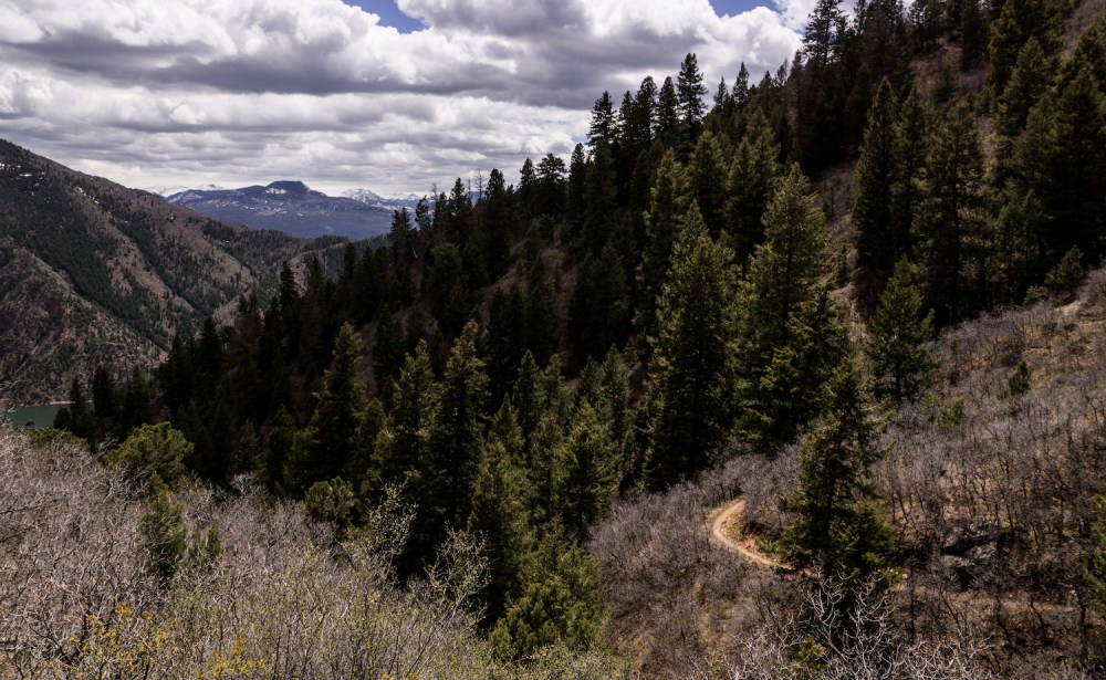
Through the trees, the trail continued to switchback downward, occasional views of the azure expanse teasing approaching hikers.

As with most descent sections of any outdoors excursion, this portion of the hiking was a breeze. I arrived at a set of picnic tables that marked the completion of the first half of the journey. Beyond the picnic tables, the rocky shores of the Morrow Point Reservoir glimmered welcomingly. Without another soul in sight, I had the scenery to myself—dare I say—like a hermit. Looking west, I could see the Morrow Point Dam, the first dam of its type to be built by the U.S. Bureau of Reclamation.

I scurried around the waterfront, taking several pictures and making great use of my polarizing filter, which cast away the harsh reflections of sunlight on the water. After some quality time with my camera, I collected my belongings in preparation for the more difficult half of the journey.

One way, the trail spans three miles from the parking lot to the reservoir, and covers almost 2000 feet of elevation change. This makes the descent pretty easy and the ascent… well, good training for the upcoming 14er season. It wasn’t long until I was grunting and sweating my way back up to the parking lot.

It was to my surprise that I saw no one else beyond the stragglers of the school field trip, even on my ascent. It only took about an hour to reascend back to the soft comforts of my Subaru seat cushions. Looking back down at the glasslike water, I reveled in the feeling of the trail beneath my feet and the mountain air in my lungs. It appeared summer was coming, and it felt wonderful.

Until next time, my friends: stay adventurous!

