Mount Hope towers above the popular recreation area of Twin Lakes, Colorado. Despite its alluring contours and inviting slopes, it is often neglected; overshadowed by its slightly taller neighbors.

Standing at an impressive 13,933′, Mount Hope is Colorado’s 64th tallest peak, and its proximity to larger and more popular summits in the Sawatch Range keep it free of congestion and pristine. Colorful aspen trees in their peak autumn displays crowded the edges of Chaffee County Road 390, where I found myself rushing to the Sheep Gulch Trailhead for a summit attempt of Mount Hope.

I was surprised to find no other cars at the trailhead, even with my late 9 AM start. However, the lack of cars didn’t mean an absence of people, as I would be following a section of the Colorado Trail to Hope Pass before ascending Mount Hope’s east ridge.

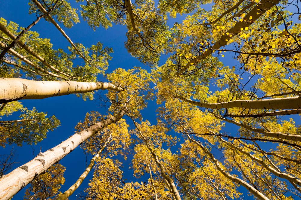
The way forward was steep and arduous: in four short miles I would be ascending over 4000′ in elevation. Forgetting the pain of ascent, I found myself distracted by the champagne-golden foliage in the aspen groves the trail climbed through.
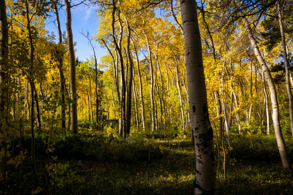

Zephyrs passed through the leaves and branches above the trail, hinting at stronger winds higher up. After about 1000′ of ascent, I paused and looked back. Sheep Gulch had opened up just enough to provide excellent views of Missouri Mountain (or at least, it’s prominent north ridge) and Mt. Belford, resting below a bluebird sky and rising high above colorful valleys.

The vista only improved the more I ascended and the more the trees thinned.

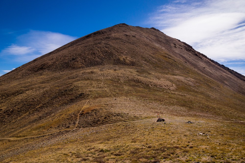
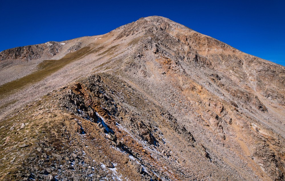
I passed into the alpine, where my first view of Mt. Hope’s summit—still thousands of feet above—served to dishearten and ironically, inspire doubt.

Without the cover of the trees, the temperatures began to dip as the winds picked up.
After donning a hoodie, and then a puffy, I followed the excellent trail to Hope Pass; nestled on the saddle between Mt. Hope and Quail Mountain.
From the pass, the Twin Lakes came into view, along with more of the Sawatch Range and the distant Mosquito Range on the horizon. Also at the pass, the winds turned from neutral gusts to violent squalls. Irritating and humorously (in hindsight), one blast of air hit the helmet suspended from my pack hard enough to swing up and strike me on the head. Are you serious?, I asked the wind, certain Aeolus was taunting me. Murmuring profanity and now heading west, I began to climb along the east ridge of Mt. Hope.
The winds continued to bludgeon my body and cut through my layers. I stuck to the ridge crest, where the difficulty did not exceed Class 2. I traversed over some bumps on the ridge to a point where the remaining route came into view.
My progress forward was slow, but was made even more sluggish because of the winds. Beyond the bumps, I encountered a loose mess of talus that took careful negotiation.
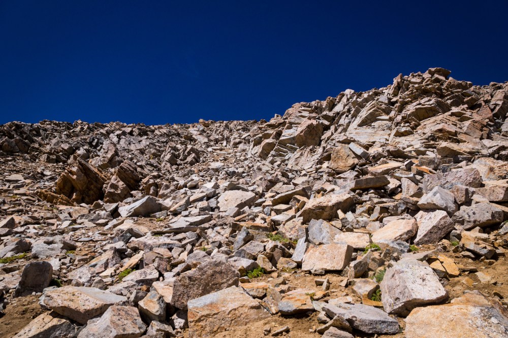
I veered south from the ridge crest to find the crux of the climb: a 300-foot, loose gulley that was supposedly easier to ascend than the ridge proper. The gulley reminded me of the south slopes of Mt. Sneffels, where one could choose between stepping on vexatious dirt and gravel, or, loose, microwave-sized talus. I stuck to the north side of the gulley in an effort to spare myself the loose mess. Fortunately, this section was brief, and I quickly regained the ridge crest.

I ascended beyond the Hopeful Couloir and could see the false summit wasn’t far off.

As I gained the false summit, and had the true summit in view, the battering winds worsened. Their forces knocked me to the ground several times as I approached the summit. I topped out and practically dove headfirst into the small wind shelter at the pinnacle of my day.

The pile of rocks provided almost no relief, so I scurried around to take photos in an effort to turn back. The scenery from the summit was outstanding; the sprawling Sawatch stretched to my north and south, a panorama of the Mosquito Range lie to the northeast, I could make out a few of the Elk Range’s summits to the northwest, and could easily pick out Uncompahgre Peak’s telltale shape from almost one hundred miles to its north.

Wondering if one can go deaf from the howling of vociferous winds, I opted to take my “summit break” somewhere far below the summit. I descended back to the false summit, and decided to try a slightly different route for my descent.
I followed the mountain’s southeast ridge for a short way, and then angled to its southeast slopes. These slopes were also loose, but required far less caution and negotiation than the gullies along the ridge. After approximately six hundred feet of descent, I angled back to the ridge, and soon returned to Hope Pass.
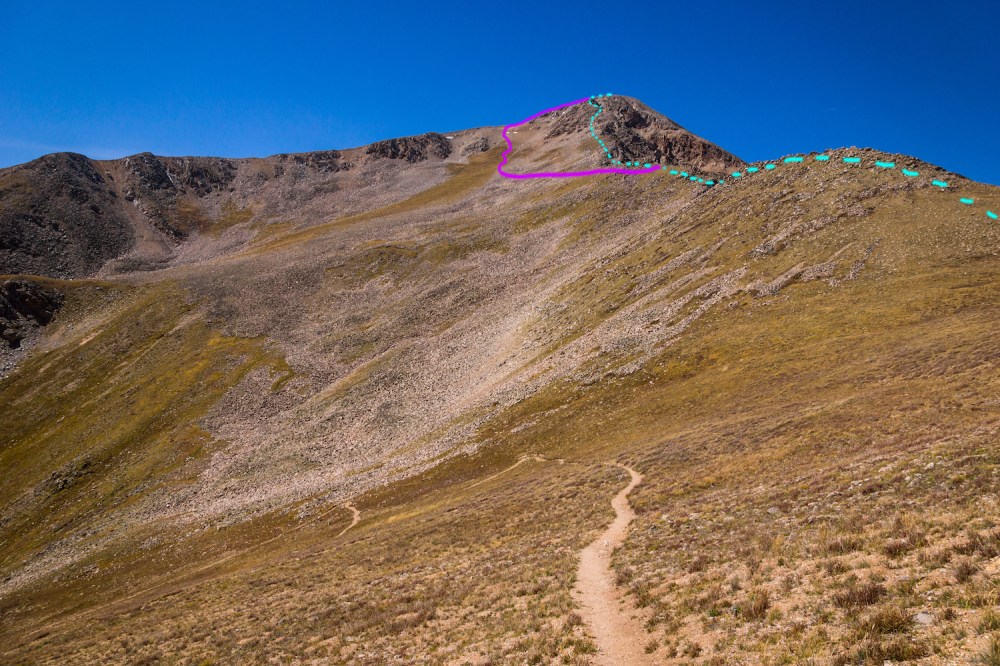
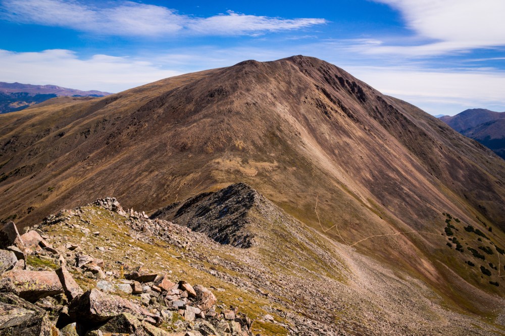
The dotted blue line above is the standard route and how I ascended, the solid purple line was the slight variation I chose to descend. The presence of a real trail was a relief after the difficulties higher up. Feeling a reasonable rhythm, I continued to descend into the Sheep Gulch, where I found a halcyon clearing with nice, natural seating. I enjoyed my delayed summit break, but didn’t pause long before continuing to go down.

Being out of shape had taken its toll, and I felt exhausted after the short, strenuous climb. My car and its many soft seats, still alone in the parking lot, gleamed its ever-inviting shade of red. Mt. Hope had been a demanding venture for me, but as with any outing into the mountains, completely worth it.

Until next time, my friends, stay adventurous!
