A little over a year ago, in May of 2023, I embarked on an unsuccessful bid for the summit of Bison Peak in Lost Creek Wilderness. I had approached the peak from the south via the Ute Creek Trail, but the ascent was cut short by deep snow drifts somewhere above 10,000′. This year I elected to wait until there were trail condition reports from other hikers who reported clear, snow-free trails. Wanting to try again, but also wanting something new, I decided to shake things up and take the approach from the north: a change that added mileage but required less elevation gain.

Sunlight was already spilling across the scenery as I reached the Lost Park Trailhead shortly after 7:30 AM. I assembled my gear and enjoyed the nearby gentle babbling of Lost Creek and Indian Creek’s confluence. I set off on the trail at 7:50 AM. The path was muddy before a small bridge allowed passage over Lost Creek.

Heading south, the trail led into the forest on the eastern perimeter of Willow Gulch, and after about half a mile I formally entered the Lost Creek Wilderness area after obtaining the required (free) self-issued permit.
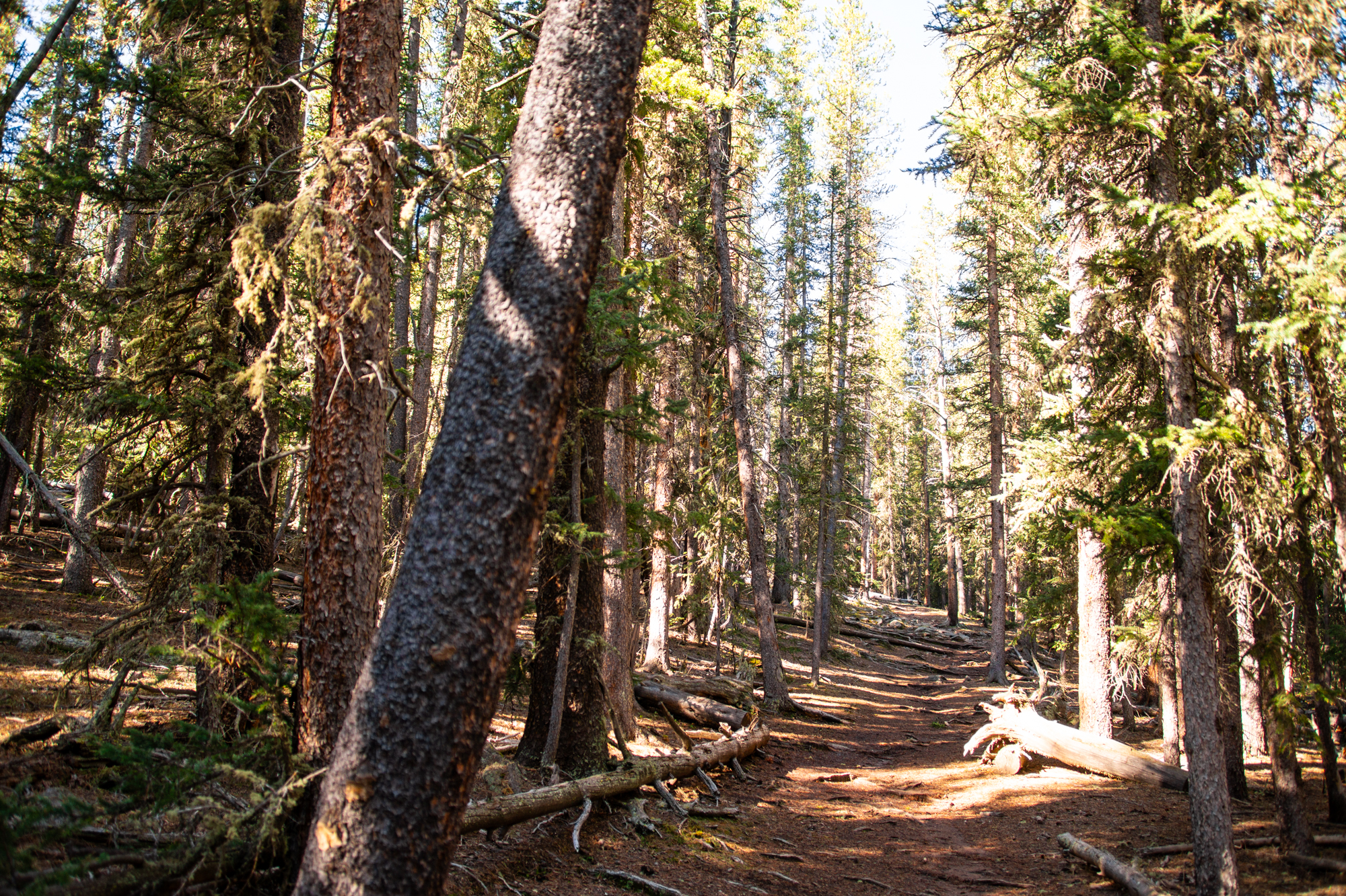
This portion of the Brookside-McCurdy trail paralleled Indian Creek. Mounds of snow—all completely avoidable for hikers—still sporadically dotted the sides of the trail and briefly had me concerned for conditions higher up.

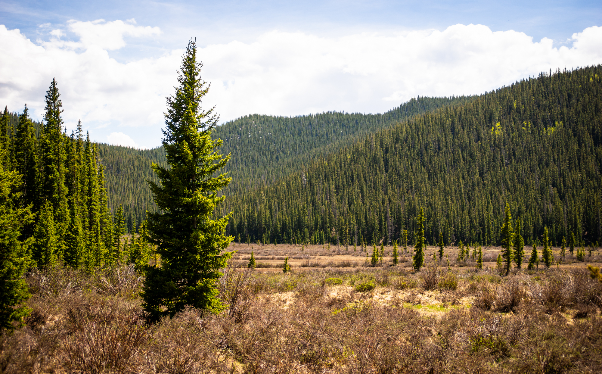
Snow-melt rendered the way forward quite wet and there was trickling water atop the majority of the path here. Mosquitoes swarmed but some new repellent I was trying out seemed to keep their presence tolerable. Near the two-mile mark, the trail exited the trees as Willow Gulch opened into a sprawling, flat, marshy park.

The skies were blue, the weather perfect, and I made frequent stops to take pictures despite tricky lighting. I continued south as the trail followed the eastern boundary of the marshy park.

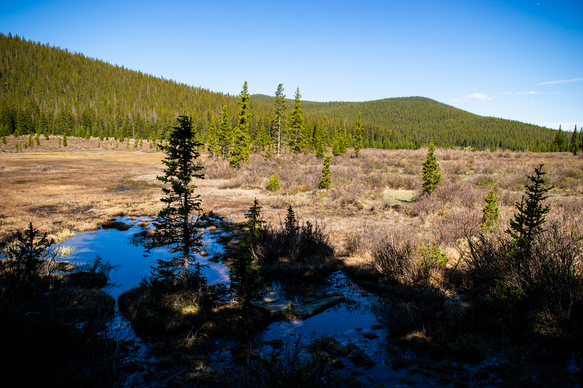
A bit after the three-mile mark, the surrounding topography narrowed the way forward and the uphill became more pronounced. The trail entered the forest once again and I bid the marshy park farewell.

I forded Indian Creek three times over the mile that followed. The crossings were easy enough but I was glad to be sporting waterproof boots. At mile five I reached the junction of the Brookside-McCurdy trail and Ute Creek trail. It was here I’d turn east and eventually loop back north to reach the summit… but not before a long hydration and snack break!

The summit was about two miles away and I still had a thousand feet of vertical to climb. As I pressed on, the incline became notably steeper, averaging around a 15% grade.

The going was slow and I lamented being out of shape. The trail reached the south slopes of an unnamed point and then sharply wound north.
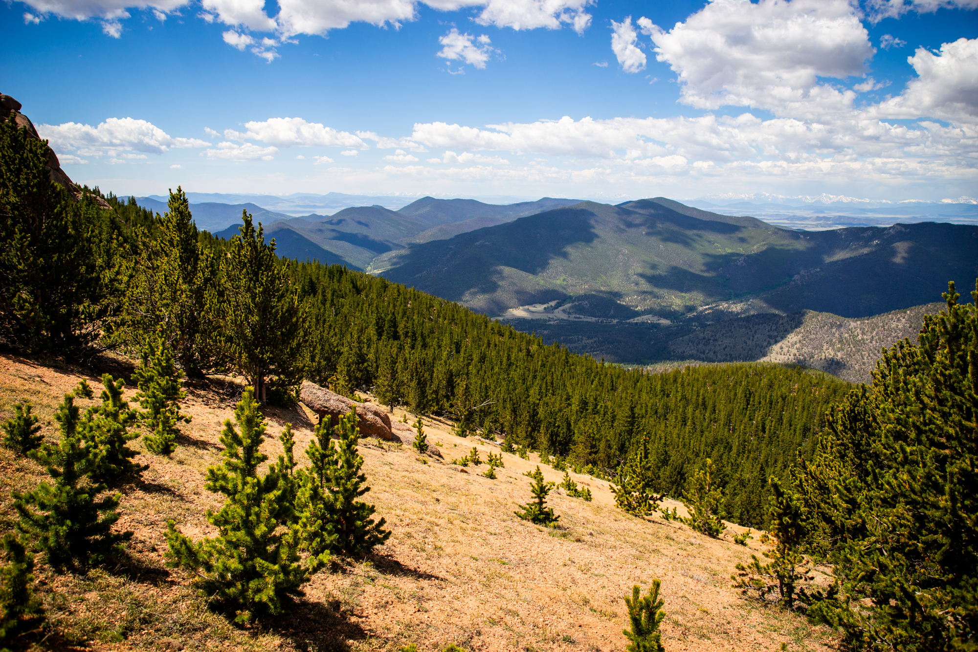
Daunting views of distant peaks came into view the higher I climbed. Winds rustled the tree branches all around. A series of switchbacks slowly led me to just under timberline where I found a sizeable plateau and some temporary respite from the arduous ascent.

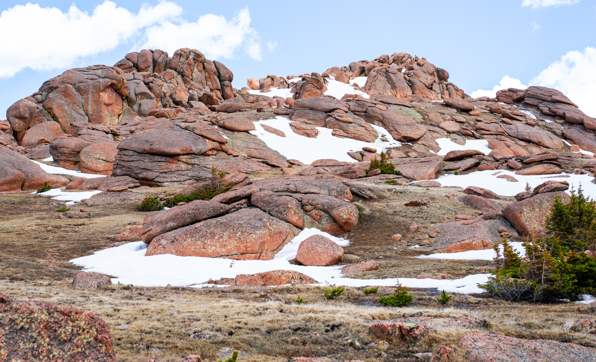
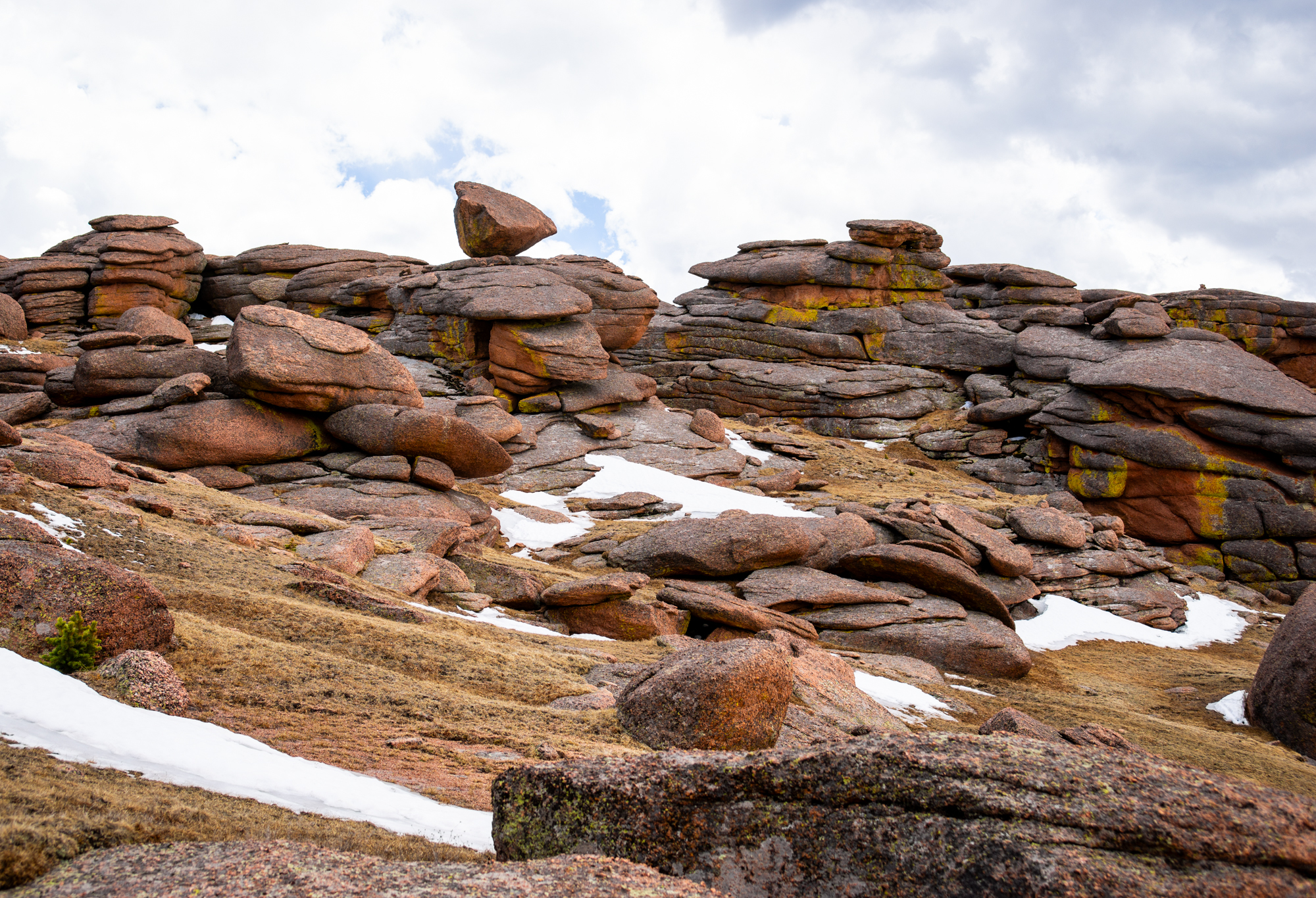
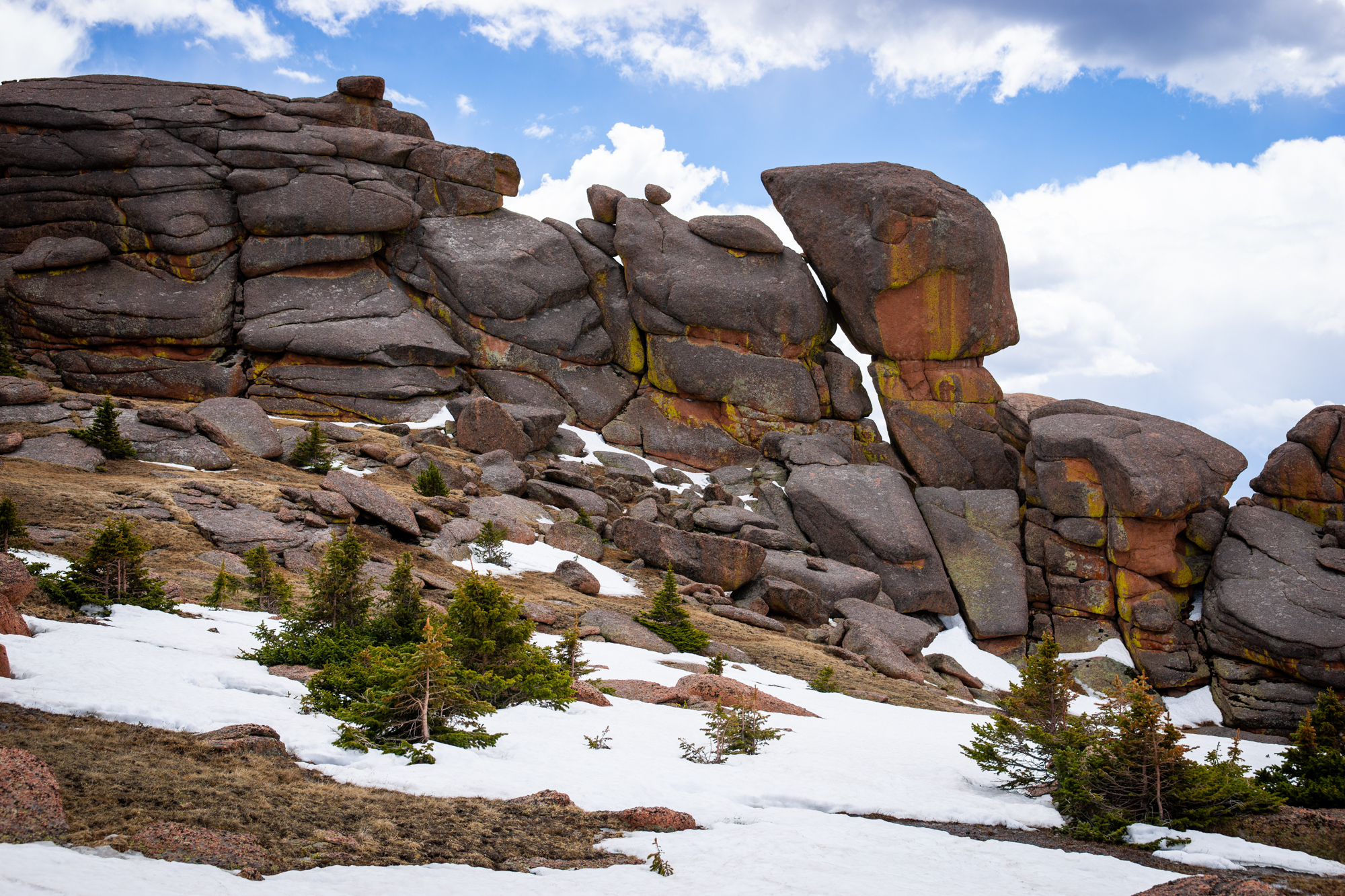
Bison Peak loomed ahead a little under a mile to the south. Intriguing, oddly-shaped granite rock formations festooned the plateau. I departed from the trail and started traversing the grassy area, taking another break once I reached the final 600′ uphill slog.

Everything hurt.

Moody storm clouds overhead crept toward the mountain. During my break, I wasn’t sure if I had the resolve to both make the summit AND get safely back below timberline before the storm rolled through. I checked the forecast with my GPS and decided it was safe enough—even with my snail’s pace—to continue
Remarkably, it wasn’t until this point that I saw other people: one party of two heading down from the summit and another solo hiker also on their way up. These parties took a direct approach to the summit block, electing to ascend over snow fields and contending with a handful of easy class 3 obstacles. I learned later that all of this could be bypassed by sticking to the peak’s upper-western slopes.
My legs jiggled like jelly when I finally reached the summit block and I made my way up the last few feet.
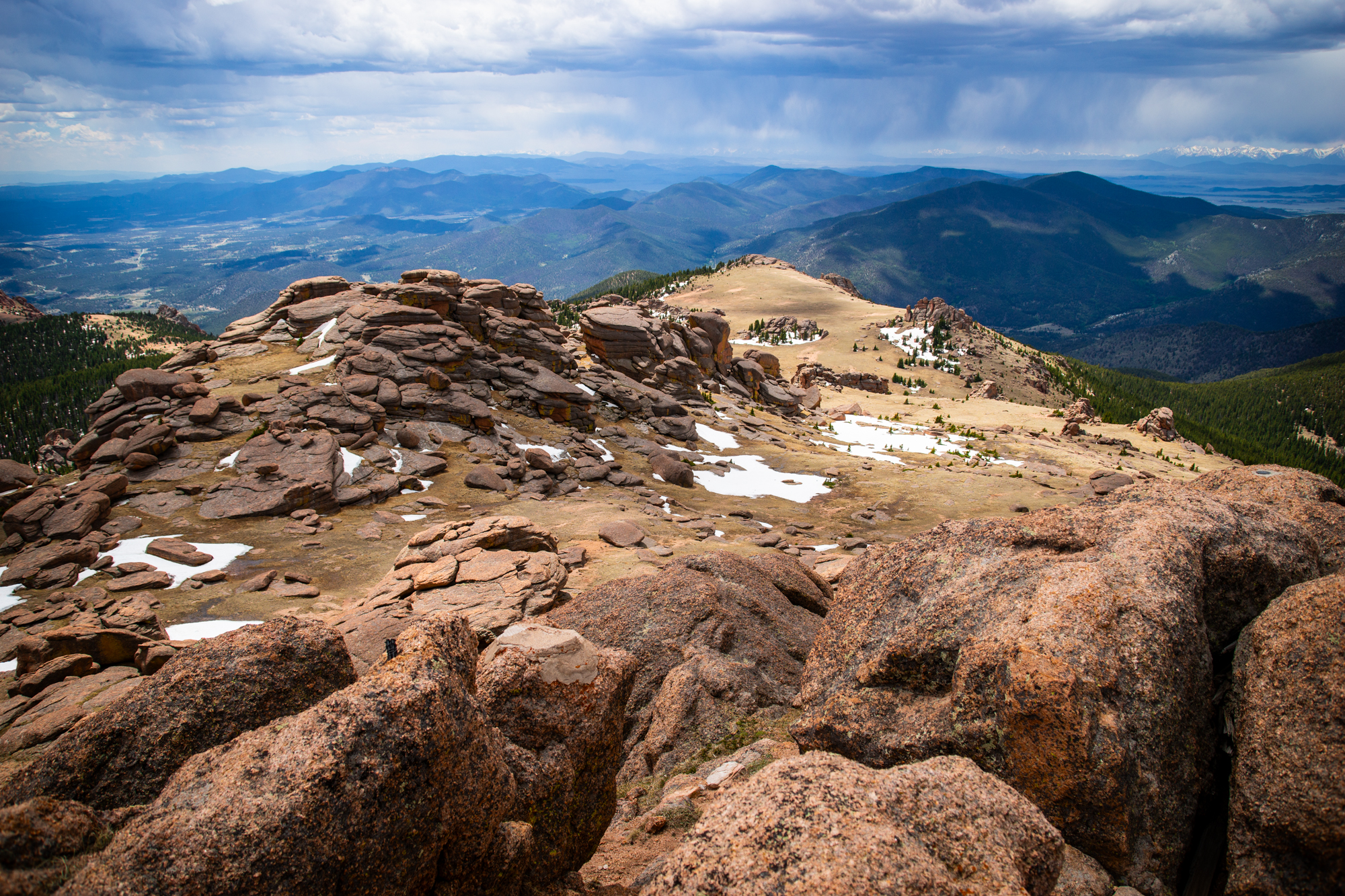
The scenery was impressive: I could pick out Mt. Blue Sky and Mt. Bierstadt twenty-five miles to the north, Pike’s Peak thirty miles to the southeast, Mt. Silverheels twenty-eight miles to the west, and even Mt. Princeton and nearby Collegiate Peaks some fifty-odd miles southwest!

It was 12:20 PM: I located the summit marker, took a handful of pictures, and planned on taking a longer break once back below timberline. The aforementioned storm clouds seemed to be rushing toward the mountain now.

I descended: taking as many pictures as I could of the bizarre rock outcroppings, traversing back across the plateau, and rejoining the trail.
Sure as rain (har har), it began to drizzle once I was back near the trail junction.

By the time I was heading north on Brookside-McCurdy trail, I could hear thunder above. Despite the hurt, I was ecstatic to have made it up and safely back down.
I often struggle with how to end these write-ups. With so many of our adventures being out and back, reaching the blog destination is technically only the halfway point, but the return is often uneventful and hurried in an effort to beat rush hour traffic getting back into town. This adventure would be different. Near my ten-mile mark, I found a backcountry campsite and set up my hammock. I devoured an orange, reapplied insect repellent, and spent an entire hour just relaxing and recharging for the rest of the way back. I knew I’d “beat” rush hour by missing it with this added time and enjoyed every second of it.
It was about 3:00 PM that I gathered my belongings and finished my return to the car: back along the side of the marshes, back through the forest, and finally back across Lost Creek.

My hike-tracking watch reported 14.5 miles total and a handsome 3,000′ of elevation gain. Not bad for getting back into the swing of summer! I can’t wait for whatever comes next.
