Good day faithful followers and casual perusers! What follows here will be a fascinating account of excitement and intrigue… in two parts! Read in awe as the Overcast Adventurers brave the Black Canyon of the Gunnison not once, but twice!
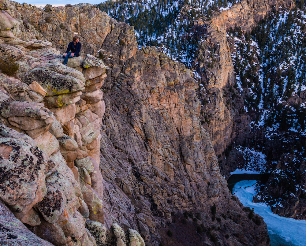
The Black Canyon is an ancient geologic feature in the Southwest quadrant of Colorado, roughly equidistant from the towns of Gunnison, Montrose, and Hotchkiss (by car). The canyon was carved out by the Gunnison River working over the course of eons. The Gunnison River, as well as the myriad of streams and creeks joining it, formerly cut away enough rock to make the canyon a hair’s breadth deeper every year. The completion of the Blue Mesa Dam in 1966 held that mighty river to a standstill, and the much more static Morrow Point Reservoir now lies at the canyon’s bottom.
A focal point of the Black Canyon is the Curecanti Needle, a looming monolith of granite at Morrow Point Reservoir’s center. It’s a popular destination for those who climb rocks, and some equally popular visual inspiration for those who don’t. It should be noted that the Needle does not actually lie within the confines of the Black Canyon of the Gunnison National Park, but rather in the Curecanti National Recreation Area. So, not only is the Curecanti Needle a beautiful natural wonder, it’s also a beautiful natural wonder that doesn’t cost $15 to access! Now, onto the main event…
Part 1: The Dark Descent
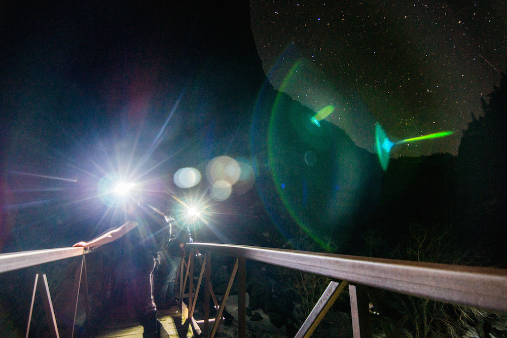
The arrival of the Spring Equinox on March 20th brought with it a boon of fair weather. The skies were clear, the snow was dissipating, and one could go outside for more than five minutes without turning blue. In keeping with the local climate’s optimism, we decided to attempt a night hike. The Curecanti Creek trail seemed like just the trick for a casual hike and a bit of astrophotography. We embarked at sunset.

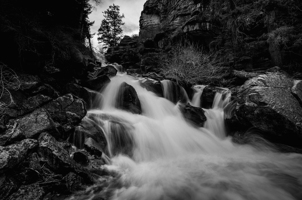
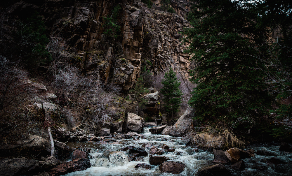
The trail descended at a gradient that nearly had us sliding down to the canyon bottom. Large patches of snow on the route helped to slow us down, but we still made impressive time in reaching the actual Curecanti Creek, and the first bridge across it. Any trolls lying in wait beneath the planks would never have known of our passing, as the creek roared with new snowmelt. We crossed and kept going down. Eventually, at a calmer portion of the waterway, we came along another bridge, identical to the first. With the end not in sight, we decided to stop the night’s trek there. But not before getting what we came for.
With visions of Spring Break and sugar plums dancing in our heads, we made the long climb back to the trailhead.

Part 2: Let’s Get To The Point
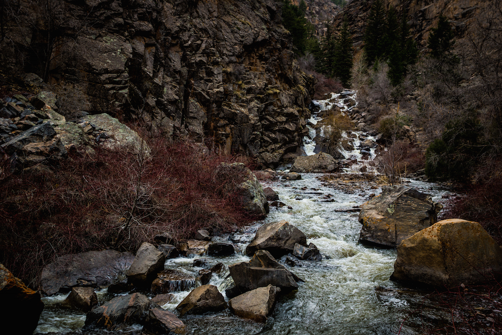
Not being the types to leave a job only partly finished, we returned to the Curecanti Creek trailhead on April 4th. This time there was plenty of daylight, and enough warmth over the previous two weeks to clear away most of the snow and ice. It took us a mere 30 minutes to reach the first bridge, with only a few mud patches to impede us. Only one or two dangerous sections remained, and we reached the second bridge in another 20 minutes. The creek’s noise remained as deafening as ever.

Past the second bridge, we descended ever further into the canyon, never straying from beside Curecanti Creek.
Another half hour of hiking brought us to the edge of Morrow Point Reservoir. The water was a calm contrast to what we had just hiked past, and it was hard to imagine the Gunnison River ever charging through that area.
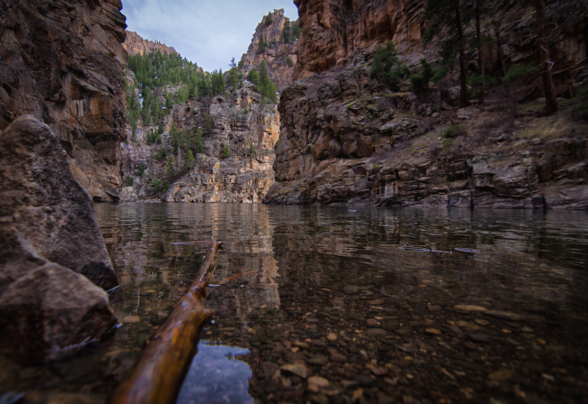
We were able to admire the view for some time before our minds turned to the climb we still had ahead of us. Going downhill is easy, but ascension is a far more difficult task.

~Ty and Sky
(Pictures courtesy of Skyler Stanley, words courtesy of Tyler Brant.)

Ooooooo a cliff hanger…
LikeLiked by 1 person
That was amazing and so complimentary. It was inspiring to read, and the pictures take your breath away! Your work belongs in National Geographic! Way to go Ty and Sky!
LikeLike