As indicated by the lack of recent posts from either Skyler or I, school has started! In our finite wisdom, we both decided to sign up for a class that took place during the two weeks prior to the official school start day. It was called Colorado Ecoregions. Essentially, this upper division biology course would provide us the opportunity to travel the state of Colorado and learn about its ecology. There was no way to guess what really awaited us.
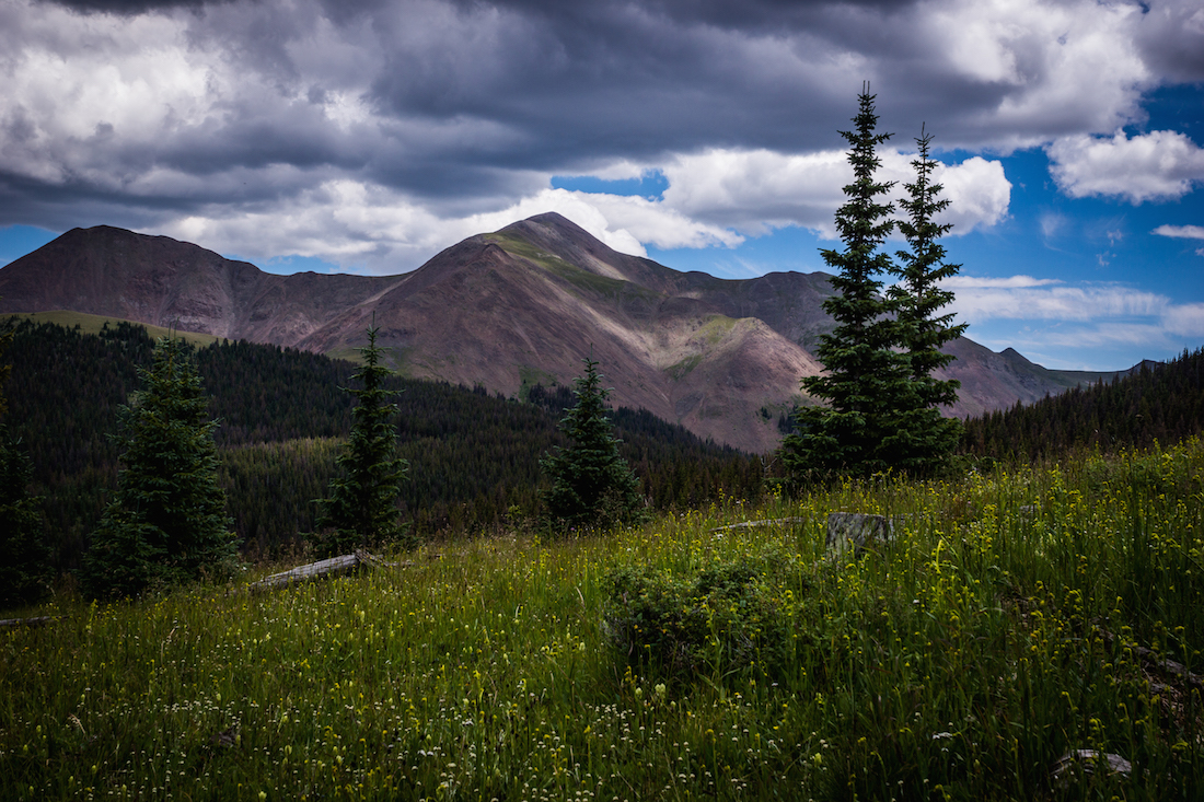
On August 10th, preparations were made by the group in Gunnison, CO. There were 14 of us to start, including our aberrant professor, and a whole lot of confusion as to the next couple days. Would there be breaks? Showers? Toilet paper? 2/3rds of those answers turned out to be no. We hit the road early in our 15-passenger van, U-haul in tow, heading East from our starting point. Highway 50 took us to the glorified trailer park of Sargents, where we then hooked a right onto a pitted dirt road. An hour of bad shocks and worse headaches later, we were at the top of Marshall Pass on the Continental Divide. Gone were the Sagebrush plains of the Gunnison Valley, replaced now with towering Lodgepole Pines, hulking Engelmann Spruce, and gnarled Bristlecone Pines. Several peaks circled around us.
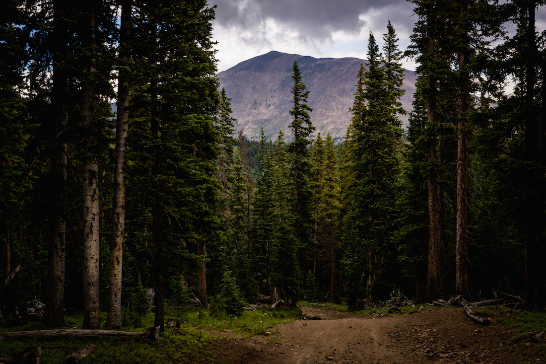
The first of what was to be many treks on this trip took us up a trail from Marshall Pass. Our destination was a spot named Headwaters Hill, a triple divide from which water flows three separate ways, feeding the Arkansas and Gunnison rivers, as well as the San Luis Valley basin. We reached the summit about midday, and found ourselves greeted by Mount Antora in the distance.
The return hike took longer than expected. Something about a classmate getting lost on the way down and being rescued by dirt-bikers was involved. We all made it back eventually though. From then it was a haul down to the San Luis Valley, where we ended up at the Orient Mine Land Trust. Besides being a clothing-optional hot springs and our camping grounds for the night, this bit of land was also home to a collapsed iron mine (the so-called “Glory Hole”) which houses a bachelor colony of around 250,000 Brazilian Free-tailed Bats. We hiked up to see the bats egress their home at dusk, hungry for moths and mosquitoes.
Most of the mornings during the course were early ones, and day two was no exception. We departed the dusty roads and aged nudists of Orient Mine to go South. The soil of the San Luis Valley is salty, and not conducive to many forms of life. A grand variety of things yet manages to survive, and even thrive, there though. Rabbit Brush and Greasewood makes a canopy there over a variety of grasses and cacti, making an ecosystem as complex as any other.
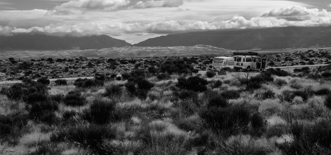
Our first major stop of the day was the Great Sand Dunes National Park & Preserve. A quick pit stop for sand-boards and caffeine was all that slowed us in that pursuit. Soon we were dashing through the sand and water, excited to explore those ephemeral hills.


We were sad when the time came to leave the Dunes. But, there was a long drive ahead. We started Eastwards again on Highway 160 in Alamosa. There was a brief stop in the town of La Veta for sandwiches and chips. An hour or so later there was another stop in Walsenburg, this time to drop off a member of the class. It would be the first, but not last time that this happened.
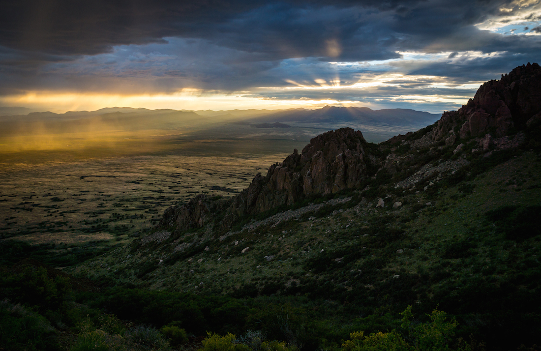
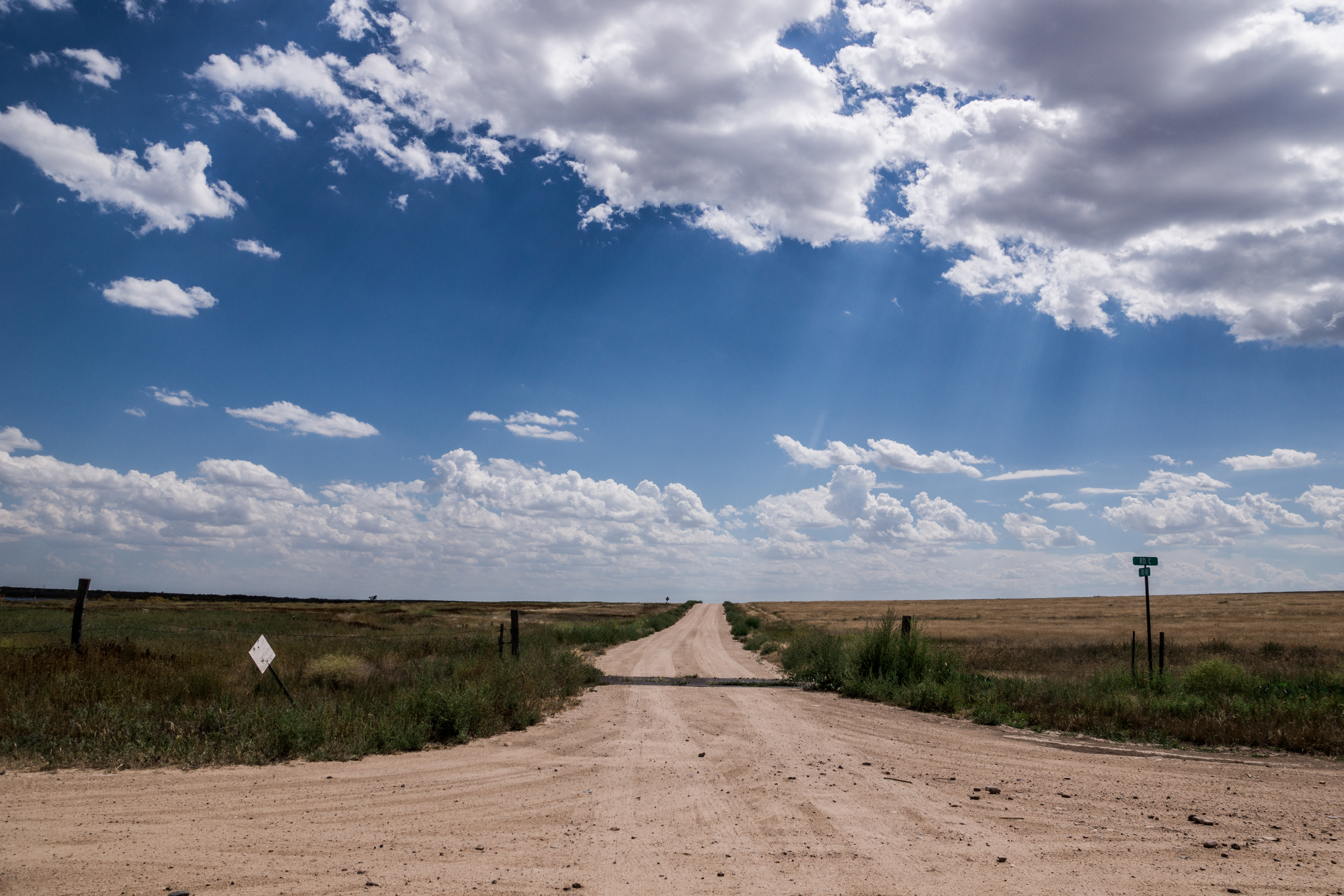
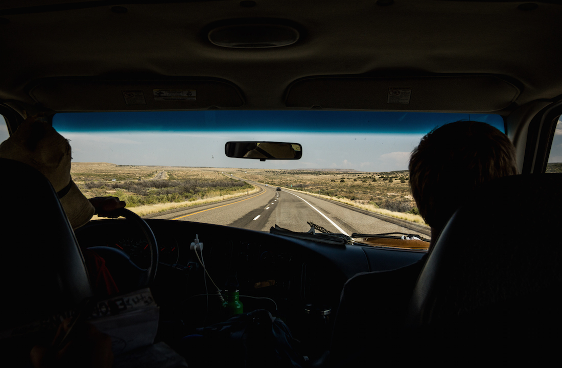
The Spanish Peaks rose up to one side as we drove, though they were gone again by the time we reached Trinidad. From there the road went towards Kim. Except, there was a problem. That problem lay in glowing red letters on the roadside, spelling out the message “Bridge out West of Kim. Alternate route advised.” We had somewhere to be, so a sharp turn of the wheel took us South again. Dark skies faced us, and soon hit us with full force. An ocean’s worth of water dropped from the sky onto us, and we nearly missed seeing the small collection of houses called Branson that we drove through. As quickly as it had started, the rain vanished just before we hit the New Mexico border. The sun returned to show us an expansive Juniper forest, overlooked by crimson mesas as we crossed the state line. We weren’t entirely sure where the roads would take us now, and so the doubt was understandable when those roads turned to dirt. Luckily, a friendly farmer by the name of Boyd set us back on the right track. Hundreds of Barn Swallows circled over his smiling face as he waved us off, likely more happy with the fact that this huge group of college students were vacating his land. We carried on down the gravel, now enjoying our adventure with a newfound confidence.

It was on that dirt road in New Mexico that Dr. Magee discovered that one should be careful while driving through mud. Still, there are worse things than a jackknifed trailer.
State highway 456 brought us to the Oklahoma border. We passed through a desolate settlement called Kenton, but saw no other such landmarks until we arrived in Boise City many hours later. We enjoyed a late dinner in a public park there, and finally found our route back North. The van was awash with beautifully screamed Bohemian Rhapsody lyrics as we crossed the border back into Colorado, and it must have been near midnight by the time we passed through Campo and entered our campgrounds at Comanche National Grasslands.
The next morning we hiked through Picture Canyon. The air was humid, and our skin was sometimes invisible beneath the clouds of mosquitoes. The Shortgrass Prairie around us had its own bewitching nature, though. Grasses intermingled with Cholla cacti as far as the eye could see. The latter was avoided religiously after one person in the class compared a brush with it as being akin to taking a staple gun to one’s skin.


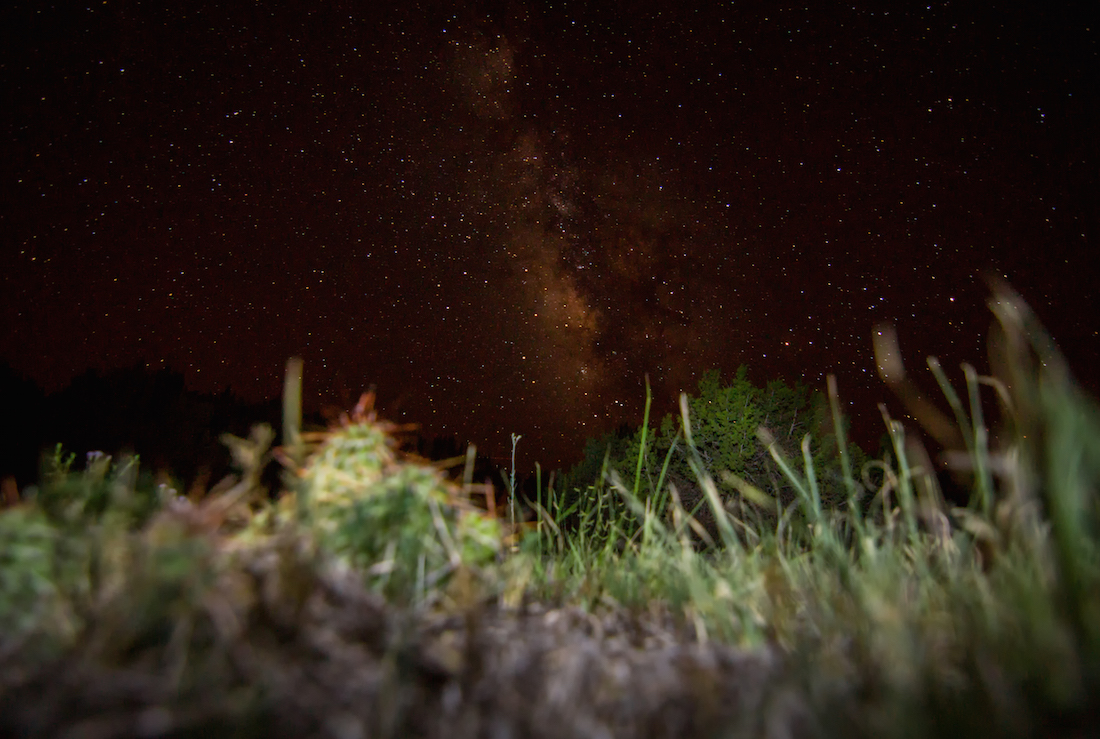
After returning to camp and packing up, we set course to Holly, a town at the lowest point in Colorado. The drive took us through several depleted fields and forlorn settlements, places that looked as if they hadn’t seen better days since before the Great Depression. In Holly, we met a Colorado Parks & Wildlife biologist named April. Working with her, we were able to survey part of a Prairie Dog colony on local ranch. Such colonies are critical for the reintroduction of Black-footed Ferrets, a species long absent from the region. From there it was a jaunt to John Martin Reservoir for a swim, and then a trip our new campsite in Vogel Canyon. It was a clear night, with the Perseids in full force to boot. We all lay on the ground and watched shooting stars well past any reasonable time.
The next morning started again with a hike. This time we walked along an old stage coach route, eventually reaching a large depression in the land. It was full of water and teeming with Leopard Frogs and Dragonflies. This was just one of many so-called Playas across the prairie. These depressions often dry out to sterility for long periods of time, but will spring to life with rainfall.
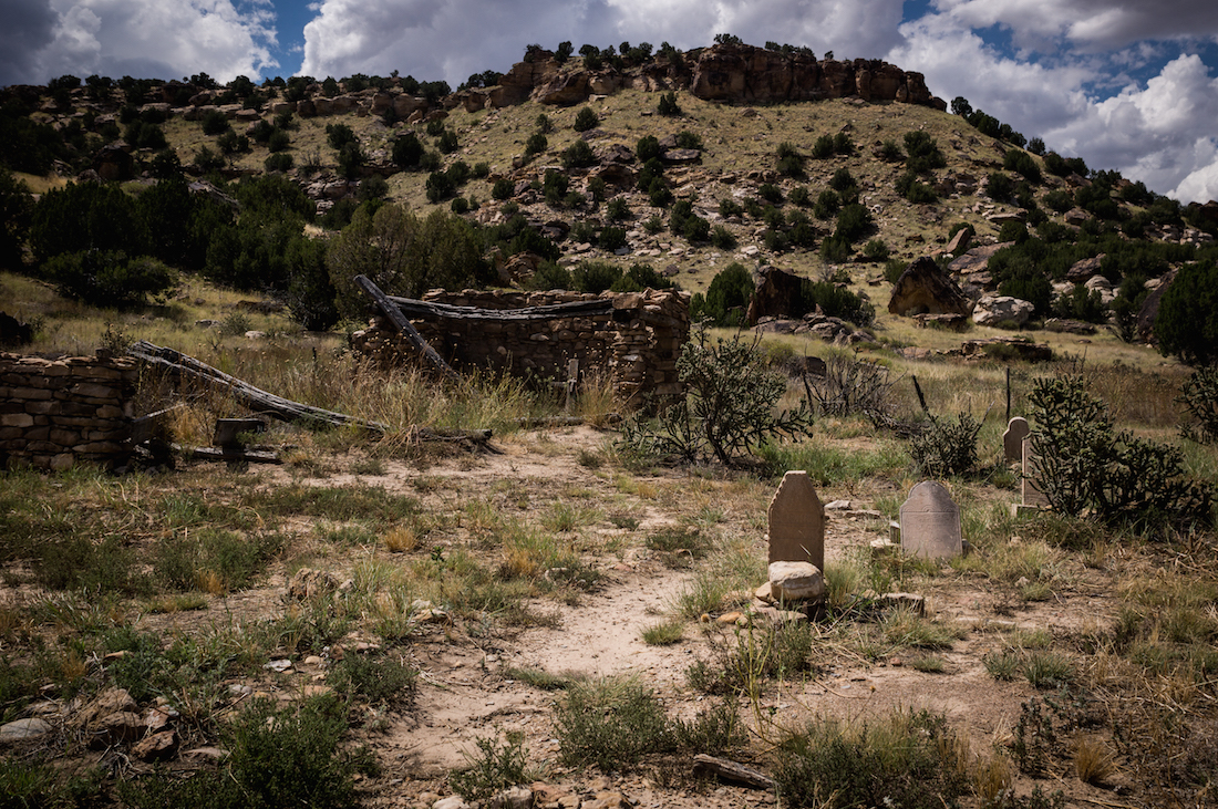
Our second hike of the day took place at Picketwire Canyon. Around 5 or 6 miles down this trail was an intersection with the Purgatoire River, where Jurassic-era dinosaur tracks sat encased in the stone. An exciting prospect, to be sure, but the tricky part was getting there. It was a hot day, and little water was available. We were little encouraged by a ghost town which we passed early on, and even less so by a collapsed church surrounded by the graves of children we spotted further on.
Regardless, we made it. Upon reaching our destination, a freak storm hit us, much like the one we had seen further West. After it passed, we were able to explore the fossil tracks and play in the river for awhile before heading back. Sleep was quick after we returned to camp.
The next started with a visit to Bent’s Old Fort, near La Junta. The castle-like building was a fun change of pace, but a brief one. We stopped for lunch outside of Neenoshe Reservoir, and some of the class went for a swim. Nobody stayed in long though, as the water was dense with rotting plant matter. We were quickly in the van again.
Next was the Sand Creek Massacre site. The Sand Sage ecosystem inhabited that area, but so did a decidedly dark aura that cast a shadow over everyone’s mood for the remainder of the day. Hundreds of innocent people had been murdered there. It chilled the blood, and we were all silent as we drove away.
From there, the road took us to Limon, and then West through Kiowa and Elizabeth. The familiar territory was exciting for me, and we reached Castle Rock in the evening. After a luxurious dinner of Chipotle burritos, we drove to Sedalia, turned left, and found a campsite in a Rampart Range parking lot.
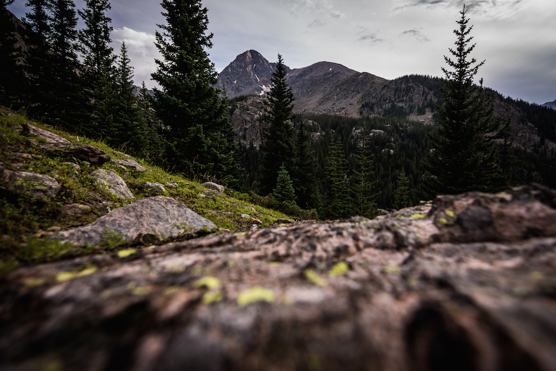
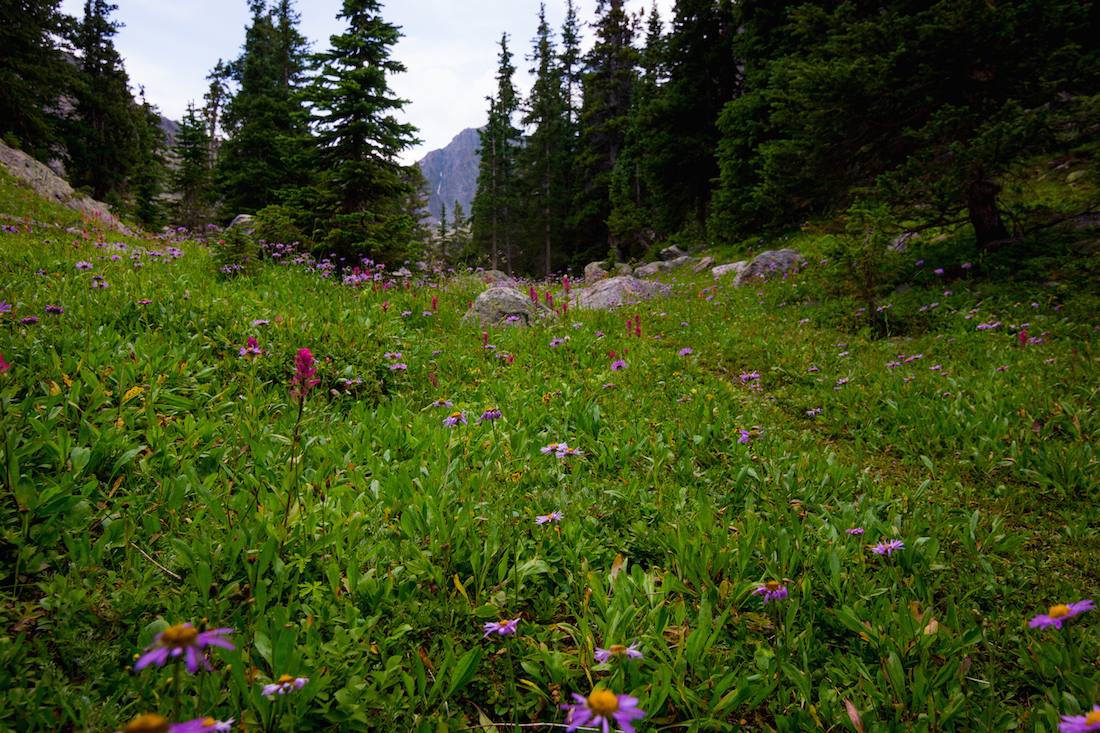
August 15th saw us fully return to the Rocky Mountains, a welcome sight after the Eastern plains. We made a quick caffeine stop in Frisco, then carried on to Minturn, and up into the Holy Cross Wilderness. The road to the trailhead we were attempting to reach was a sad sight. Cars were everywhere, and it was a miracle feat getting through them and finding parking for ourselves. After finding a spot, we took time to load up backpacks, and then started off for a multi-day backpacking trek. It was 3 miles to our campsite, 1,000 ft up and 1,000 ft back down. We arrived at East Cross Creek exhausted, but reveling in the mountains and evergreens.

Our first campsite turned out to be a poor choice, as an afternoon rain storm left Skyler and I’s tent floating in a small pond. We relocated to what turned out to be a much better spot.
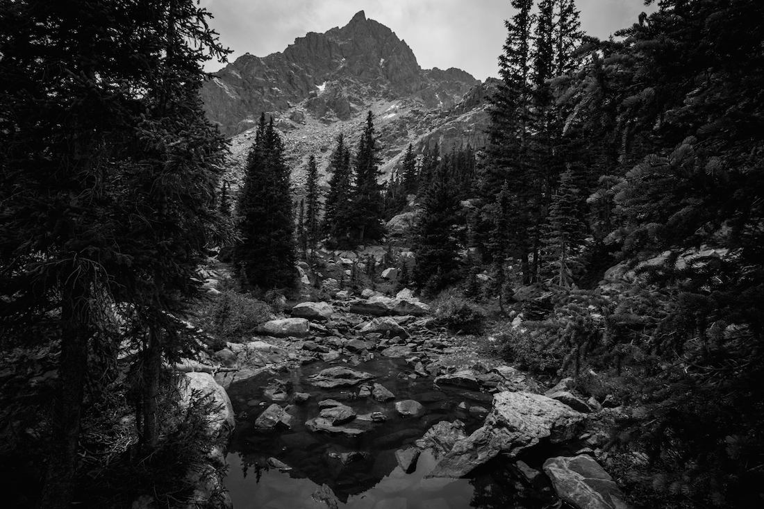
The group set a plan to be up before first light the next morning, in order to make a strong start towards the summit of Mt. of the Holy Cross. 4:30am rolled around, and Dr. Magee made the rounds to start waking everyone up. He was interrupted by a roll of thunder and a sprinkling of raindrops. Back to bed. We weren’t able to get a start until well into the morning. But, we hiked anyhow. The mountain beckoned.
The trail rapidly took us above tree-line to the Alpine. And, once among the rocks, we were assaulted by the whistling calls of Pikas and Yellow-bellied Marmots. The final part of our ascent was a scramble up a boulder field. It was difficult, and not everyone made the summit, sadly. Even for those of us who did, impending weather made sure our celebration was brief. We celebrated nonetheless.


The return hike to East Cross Creek took half the time. It was another night of talking around the camp stoves before we turned in and slept as deeply as the forest floor would let us.
The Bowl of Tears is an Alpine lake in the Holy Cross Wilderness, and was our goal for the next morning’s hike. There was no official trail to it, so we made do with following cairns in the direction that looked correct. The route went up into cliffs and areas more akin to a rainforest than sub-alpine forest. Clouds floated threateningly overhead, but we trudged on. Finally, we stopped in a meadow to plan and pound back some hummus. We decided to carry on, despite darkening skies. We ventured through ever more beautiful areas as we progressed.
While climbing up an open boulder field, thunder suddenly cracked the air. Yells of “abort!” accompanied the slapping of our shoes as the class ran to the cover of trees. Our plans were canceled, and everyone made way back to camp. The skies never truly dumped on us, but we were too spread out to turn back by the time we realized it would be safe to do so.

We spent one more night enjoying the mountain air in the Holy Cross Wilderness, meditating and then hiking out the next morning. A couple members of the group, including myself, experienced some sickness on the drive out from the trailhead. Unfortunately, I don’t remember much, other than that we had to drop off another member of our group during the drive. We reached Grand Junction in the evening, and ate at a restaurant there. That night was spent camping under the stars at Colorado National Monument. Scorpions be damned.
After collecting Pinyon Pine nuts the next morning, we went to Loma, where we met with river guides. We would be traveling with them on the Colorado River over the course of the trip’s final three days. Unfortunately, Skyler’s camera doesn’t play nice with water, so he couldn’t provide any pictures from that stretch. We spent those days hiking through desert canyons, including Rattlesnake Canyon and Mee Canyon, and the nights sleeping on sandy beaches. At some point on the third day, after hiking to old pictographs and reviewing river ecology, we finally crossed the border into Utah. We left the Colorado River at Westwater Ranger Station. The raft guides said their goodbyes, and we were quickly on the highway back towards Colorado.
There was a brief stop in Grand Junction for ice cream, and then the long haul back to Gunnison was made. Delta, Olathe, and Montrose flew by in the windows with nary a second glance from anyone in the van. By the time we were driving by Blue Mesa Reservoir, everyone was getting jittery to be back. It had been a trip for the ages, but people were ready to get back to the order of their normal lives. By the time we pulled back into the parking lot at Western State, the class was rushing to grab their things and go. Hurried goodbyes were said through hugs, and separate ways were taken. It was a hell of a ride, but one that was at its end. That long path through Colorado, and a few other states, had been worth it though.
Til next time…

~Ty and Sky

Tyler,
We are so proud of you and your writing. What a neat experience for you and your classmates, and to have it documented so professionally. The words and pictures compliment each other. You two need to work for National Geographic!
Love, Grandma and Grandpa
LikeLike
SO FREAKING COOL, Tyler!! Thanks for sharing your awesome experience!!
LikeLike