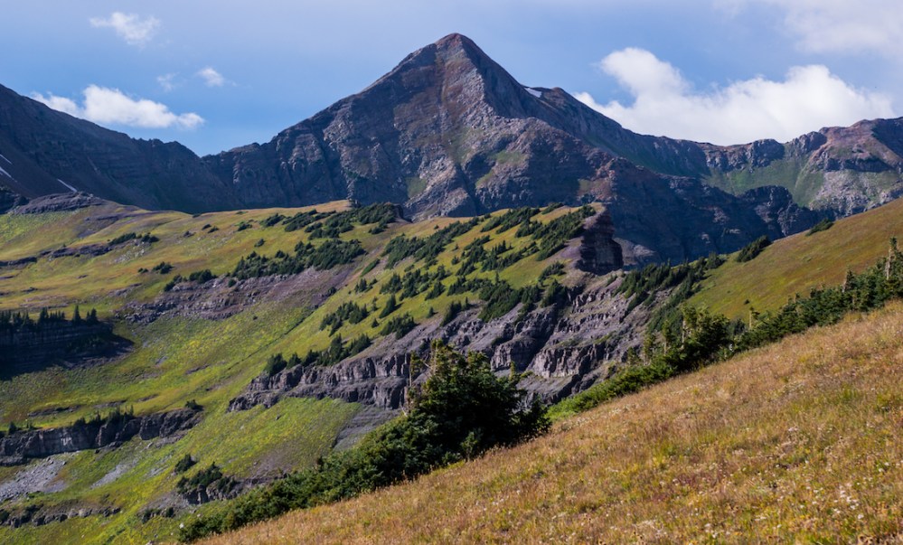
To the north of Lake Irwin, a popular recreation area near Crested Butte, a wall of cliffs acts as a gate to the pristine Raggeds Wilderness. These cliffs span roughly three miles and rise hundreds of feet above the basins that sculpt the Raggeds. It was over the course of millions of years that erosion crafted this escarpment—a truly natural and starkly vertical barricade. This geologic feature is known as Scarp Ridge. In the Raggeds, beyond and below these treacherous cliffs, lies Blue Lake. The quickest access to the shores of this azure oasis requires one to scale the zenith of the Scarp Ridge, only to descend thousands of feet on the other side. It was time to storm the gates.
The Overcast Adventurers have visited Scarp Ridge a couple of times, being met once with harsh weather but always with unending views. Despite this, I had forgotten about the difficulty of the road beyond Lake Irwin required to reach the trailhead.
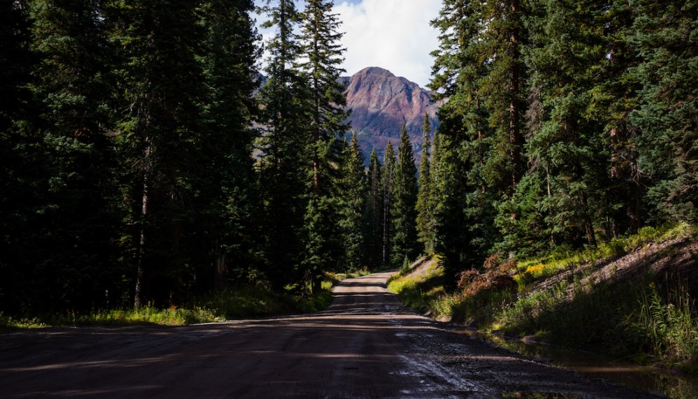
Though only a few miles in length, this section of driving (which I would later discover was an unmarked 4WD road) had me grinding my teeth and my Subaru Outback crying. My car was granted a reprieve from the assault as I parked and began to hastily make my way up the trail.
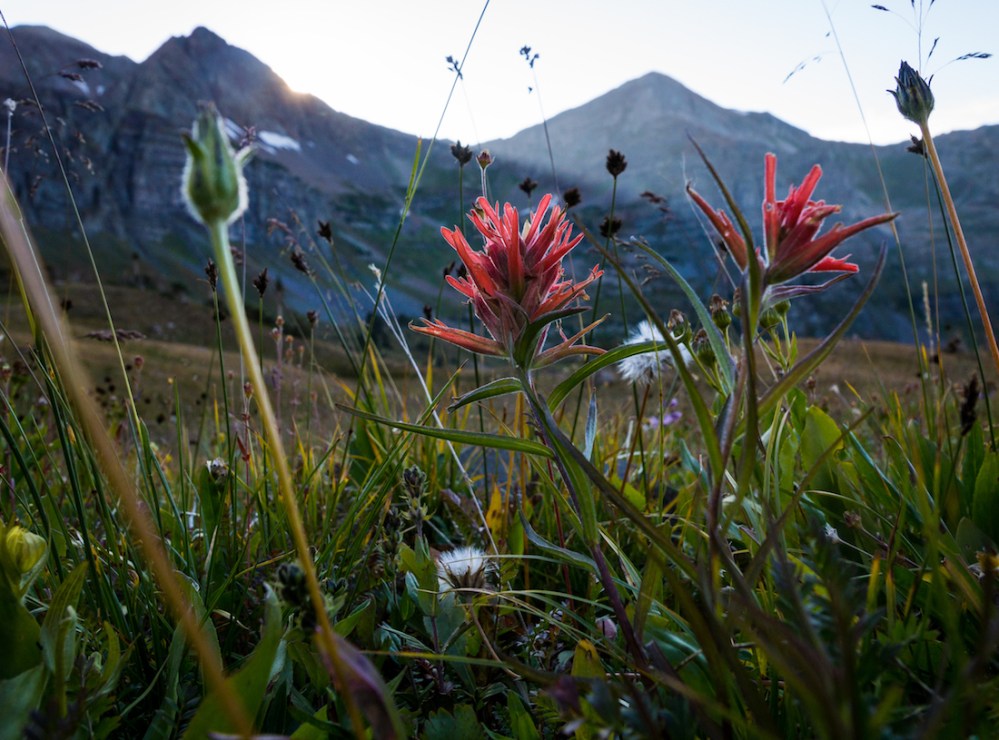
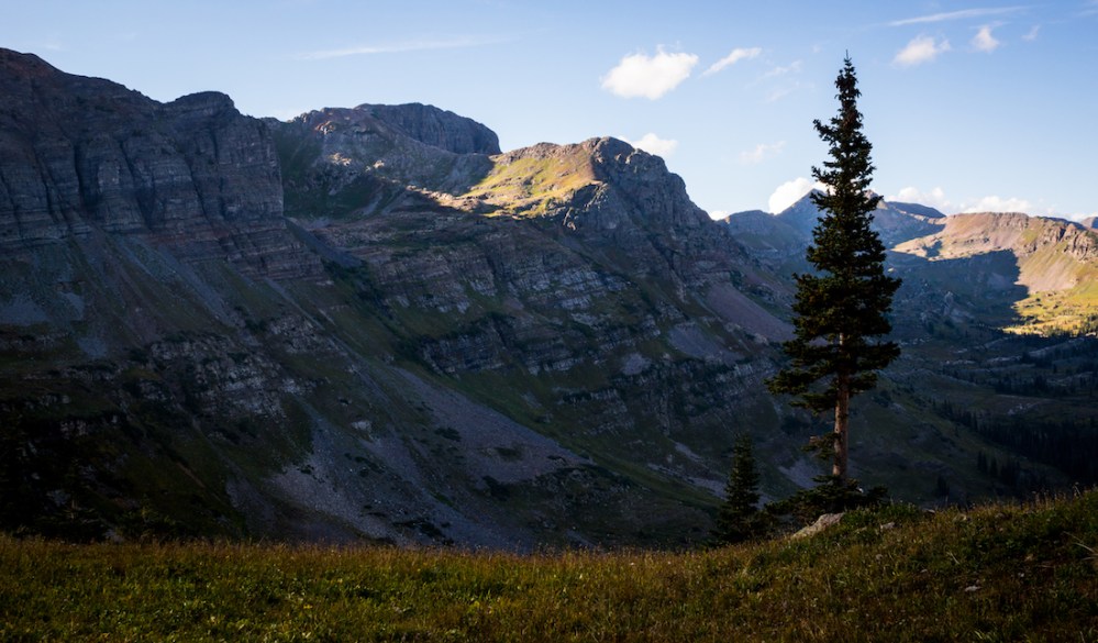
The trail starts off winding through pine forest before gracing intermittent verdant meadows.
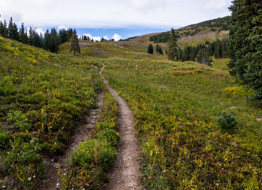
The Anthracite Range rose high to the south, and Mt. Owens and Purple Peak were almost always visible to the west.

Though late in the season, wildflowers still festooned the grasses. Indian Paintbrushes, Alpine Sunflowers, and Parry’s Bellflowers swayed in the wind at my feet.
The top of the escarpment is just shy of two miles away from the trailhead, though one must climb over 1,500 feet to top out—the equivalent of climbing the tallest skyscraper in Denver twice. It took me roughly an hour to reach the gates.
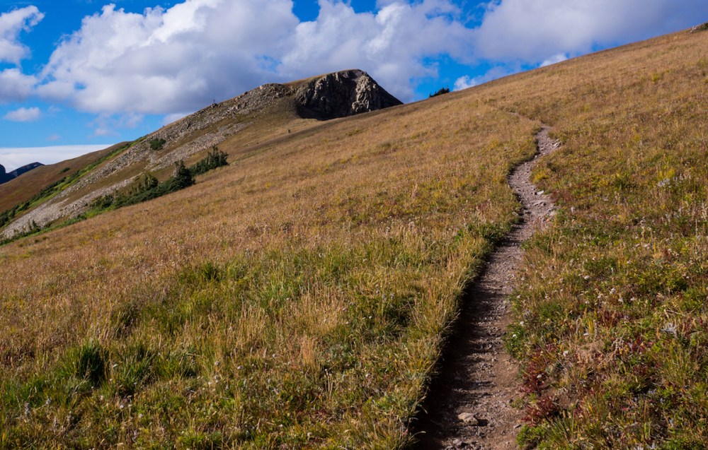
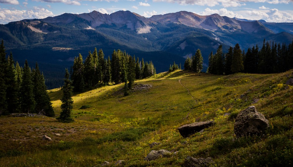
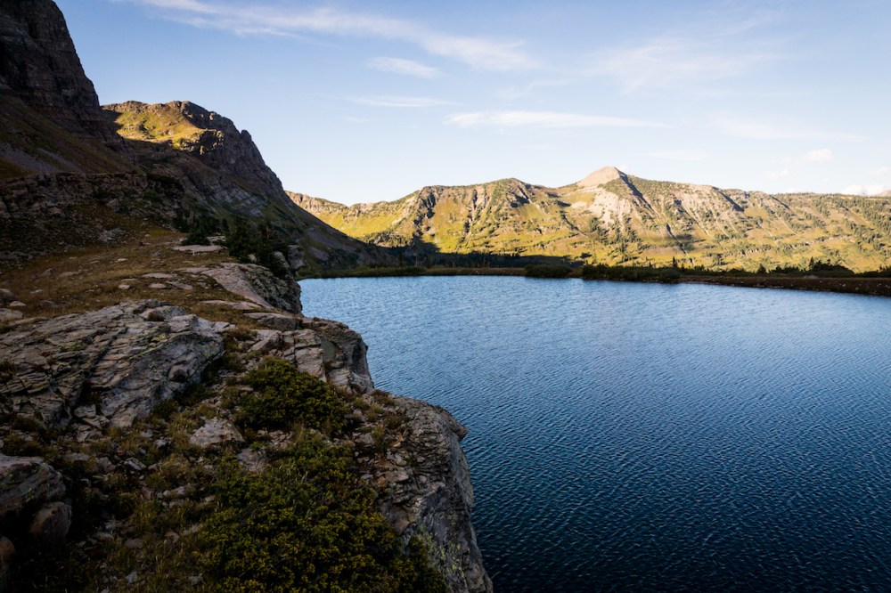
Just to reach this high point is an incredibly rewarding experience. Not only does Blue Lake come into view, but many of the Elk Range’s daunting summits can be seen puncturing the horizon.
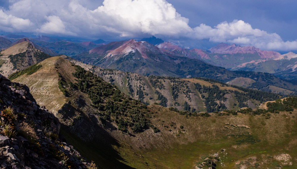
These visible mountains include Maroon Peak, Pyramid Peak, Castle Peak, Conundrum Peak, and Snowmass Mountain—just to name a few!
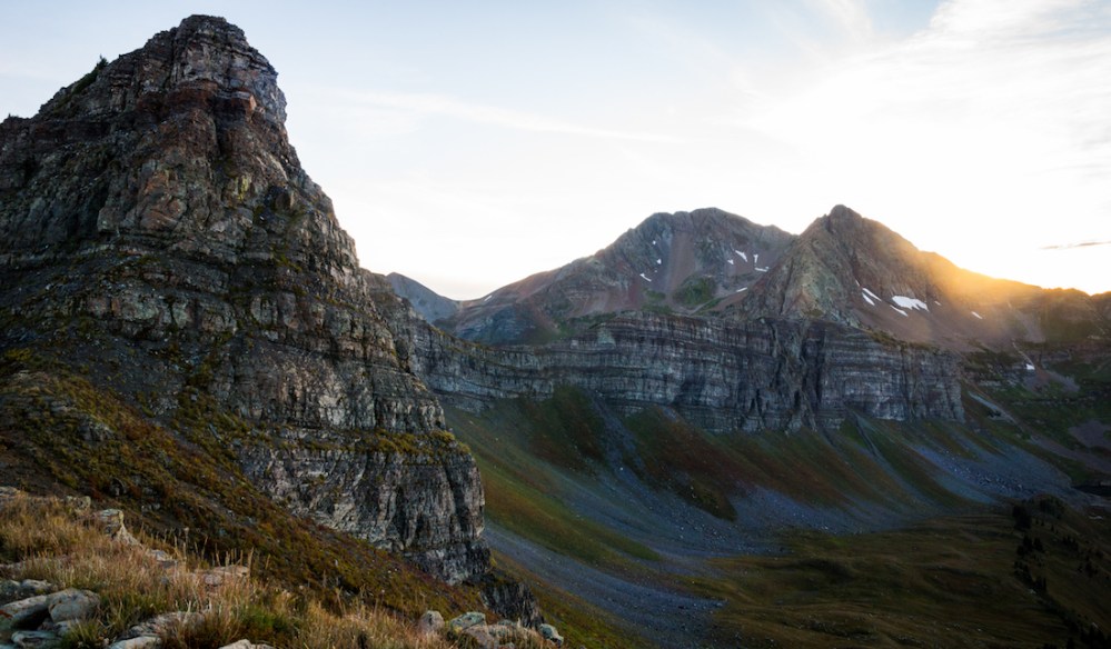
I spared no time to rest or hydrate at the top, eager to break new ground at last. Ty and I had once tried to reach the lake by following a trail that was marked on my older map of the Gunnison area, but we were met only with impossibly dangerous cliffs. US Forest Service topographic maps show no such trail—only a dead-end atop the escarpment. I took a route similar to the one we had before, edging further east than on our previous attempt to descend a nasty scree-ridden slope towards Peeler Lakes.

This allowed me to connect with Trail 404, right below Garfield Peak. From here I wended down into the unnamed basin that harbors Blue Lake. Descending from the top of the Scarp Ridge to the lake entails over 2,000 feet of elevation loss…

…loss that would need to be recouped upon my return. I tried not to think about that. Though a trail-fork is indicated on US Forest Service topographic maps, I found no such fork and ended up bush-whacking—pretty tame in the sub-alpine—for about a mile.
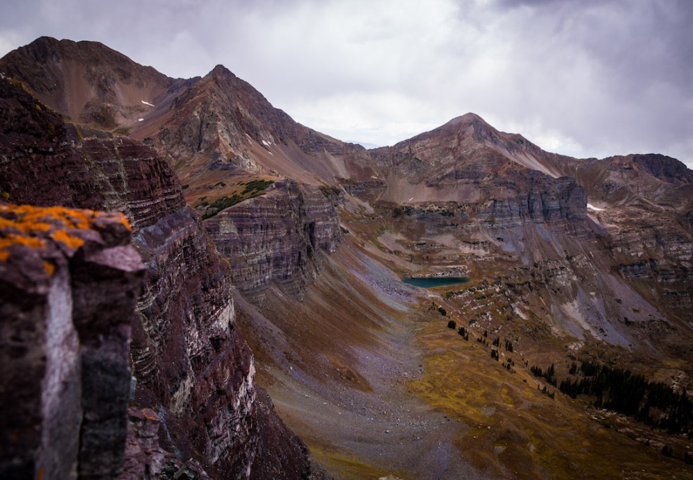
I approached the lake, surrounded by the towering cliffs.

Though they are noticeable from the top of the escarpment, it was from this perspective that I garnered a deeper appreciation for the tidy maroon striations adorning the cliffs. Purple Peak and Afley Peak rose high above the lake, as well. The surface of the water, as clear as glass, was ruffled by the brisk winds accompanying the sunset.
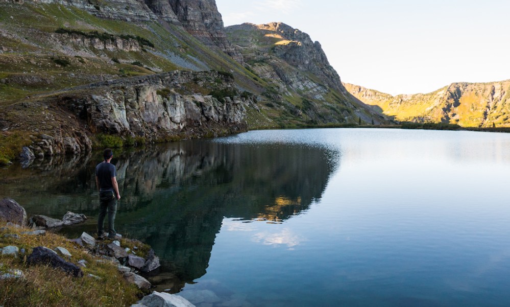
I set my pack aside and got to work with my camera, circling the lake and snapping myriad pictures. Fleeting sunlight brought shimmers of life to the surrounding topography reflected in the still water.

I embraced the moment; my cares were none.
The sun began to disappear behind Purple Peak and I, lacking a headlamp, knew I needed to turn back. Content with the outcome of the hike, I collected my belongings and bid adieu to the perfect sapphire waters. It was time to face the thousands of feet I needed to reascend. Though the trek was onerous, I felt energized enough to jaunt over to the summit of Garfield Peak (12,060 feet), a mere half-mile detour.

It took almost two hours to regain the Scarp Ridge. Receding alpenglow caressed Mt. Emmons and the distant Elks and Sawatch.


The air became colder and colder. I jogged most of the way back to the trailhead. Back at the car, I couldn’t help but think, What a wonderful start to the weekend.
And it was.
Until next time, my friends, stay adventurous.
